MOD Modoc Plateau, CA - Earthquake Result Viewer
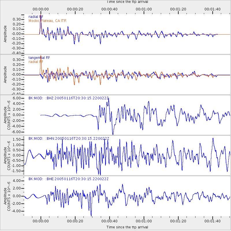
Earthquake location: W. Caroline Islands, Micronesia
Earthquake latitude/longitude: 10.9/140.8
Earthquake time(UTC): 2005/01/16 (016) 20:17:52 GMT
Earthquake Depth: 25 km
Earthquake Magnitude: 6.3 MB, 6.7 MS, 6.6 MW, 6.6 MW
Earthquake Catalog/Contributor: WHDF/NEIC
Network: BK Berkeley Digital Seismograph Network
Station: MOD Modoc Plateau, CA
Lat/Lon: 41.90 N/120.30 W
Elevation: 1554 m
Distance: 89.3 deg
Az: 47.533 deg
Baz: 283.963 deg
Ray Param: 0.04193839
Estimated Moho Depth: 40.0 km
Estimated Crust Vp/Vs: 1.64
Assumed Crust Vp: 6.566 km/s
Estimated Crust Vs: 3.992 km/s
Estimated Crust Poisson's Ratio: 0.21
Radial Match: 86.922935 %
Radial Bump: 400
Transverse Match: 81.82885 %
Transverse Bump: 400
SOD ConfigId: 5233
Insert Time: 2010-03-05 19:39:48.709 +0000
GWidth: 2.5
Max Bumps: 400
Tol: 0.001

Signal To Noise

ChannelStoNSTALTA
BK:MOD: :BHN:20050116T20:30:15.220022Z0.60611172.1531302E-73.5523652E-7
BK:MOD: :BHE:20050116T20:30:15.220022Z1.61592665.579037E-73.452531E-7
BK:MOD: :BHZ:20050116T20:30:15.220022Z8.0332661.7092891E-62.1277637E-7
Arrivals
Ps4.0 SECOND
PpPs16 SECOND
PsPs/PpSs20 SECOND