You are here: Home > Network List > AK - Alaska Regional Network Stations List
> Station CUT Chulitna, AK, USA > Earthquake Result Viewer
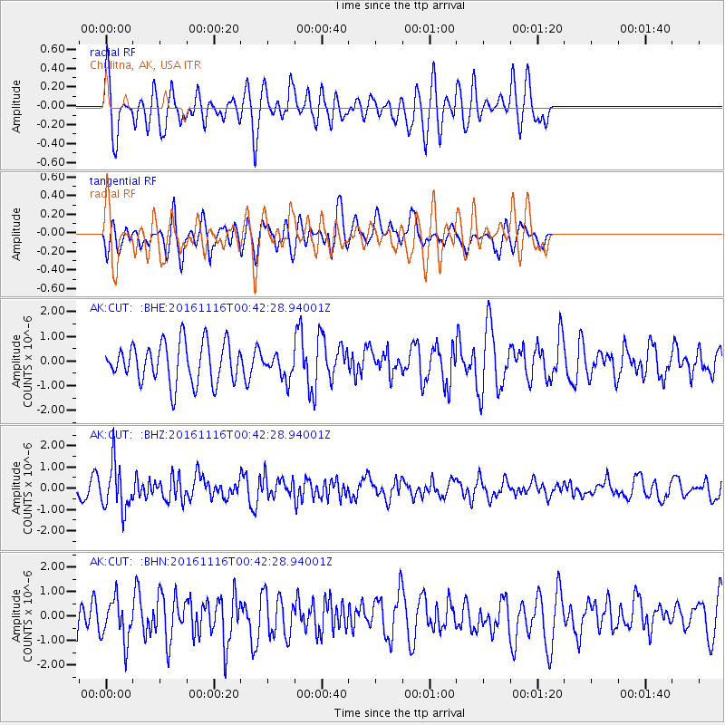
CUT Chulitna, AK, USA - Earthquake Result Viewer
*The percent match for this event was below the threshold and hence no stack was calculated.
| Earthquake location: |
Tonga Islands Region |
| Earthquake latitude/longitude: |
-20.2/-173.0 |
| Earthquake time(UTC): |
2016/11/16 (321) 00:30:28 GMT |
| Earthquake Depth: |
10 km |
| Earthquake Magnitude: |
5.9 MB, 5.6 MWB |
| Earthquake Catalog/Contributor: |
NEIC PDE/NEIC COMCAT |
|
| Network: |
AK Alaska Regional Network |
| Station: |
CUT Chulitna, AK, USA |
| Lat/Lon: |
62.41 N/150.26 W |
| Elevation: |
574 m |
|
| Distance: |
84.3 deg |
| Az: |
10.405 deg |
| Baz: |
201.364 deg |
| Ray Param: |
$rayparam |
*The percent match for this event was below the threshold and hence was not used in the summary stack. |
|
| Radial Match: |
55.477253 % |
| Radial Bump: |
400 |
| Transverse Match: |
46.58913 % |
| Transverse Bump: |
400 |
| SOD ConfigId: |
11737051 |
| Insert Time: |
2019-04-26 02:14:17.759 +0000 |
| GWidth: |
2.5 |
| Max Bumps: |
400 |
| Tol: |
0.001 |
|
Signal To Noise
| Channel | StoN | STA | LTA |
| AK:CUT: :BHZ:20161116T00:42:28.94001Z | 3.3216248 | 1.0805559E-6 | 3.2530946E-7 |
| AK:CUT: :BHN:20161116T00:42:28.94001Z | 0.9174109 | 8.6220075E-7 | 9.398196E-7 |
| AK:CUT: :BHE:20161116T00:42:28.94001Z | 0.6056931 | 4.9035657E-7 | 8.0957926E-7 |
| Arrivals |
| Ps | |
| PpPs | |
| PsPs/PpSs | |


