You are here: Home > Network List > AK - Alaska Regional Network Stations List
> Station MDM Murphy Dome > Earthquake Result Viewer
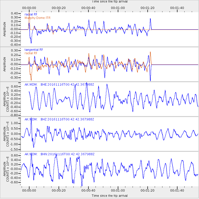
MDM Murphy Dome - Earthquake Result Viewer
*The percent match for this event was below the threshold and hence no stack was calculated.
| Earthquake location: |
Tonga Islands Region |
| Earthquake latitude/longitude: |
-20.2/-173.0 |
| Earthquake time(UTC): |
2016/11/16 (321) 00:30:28 GMT |
| Earthquake Depth: |
10 km |
| Earthquake Magnitude: |
5.9 MB, 5.6 MWB |
| Earthquake Catalog/Contributor: |
NEIC PDE/NEIC COMCAT |
|
| Network: |
AK Alaska Regional Network |
| Station: |
MDM Murphy Dome |
| Lat/Lon: |
64.96 N/148.23 W |
| Elevation: |
634 m |
|
| Distance: |
87.0 deg |
| Az: |
10.272 deg |
| Baz: |
203.174 deg |
| Ray Param: |
$rayparam |
*The percent match for this event was below the threshold and hence was not used in the summary stack. |
|
| Radial Match: |
63.56047 % |
| Radial Bump: |
400 |
| Transverse Match: |
54.241276 % |
| Transverse Bump: |
400 |
| SOD ConfigId: |
11737051 |
| Insert Time: |
2019-04-26 02:14:27.173 +0000 |
| GWidth: |
2.5 |
| Max Bumps: |
400 |
| Tol: |
0.001 |
|
Signal To Noise
| Channel | StoN | STA | LTA |
| AK:MDM: :BHZ:20161116T00:42:42.367988Z | 3.1834853 | 6.7843115E-7 | 2.1310956E-7 |
| AK:MDM: :BHN:20161116T00:42:42.367988Z | 1.2163607 | 3.0638694E-7 | 2.5188822E-7 |
| AK:MDM: :BHE:20161116T00:42:42.367988Z | 1.2762482 | 3.7339635E-7 | 2.9257345E-7 |
| Arrivals |
| Ps | |
| PpPs | |
| PsPs/PpSs | |


