You are here: Home > Network List > AZ - ANZA Regional Network Stations List
> Station LVA2 AZ.LVA2 > Earthquake Result Viewer
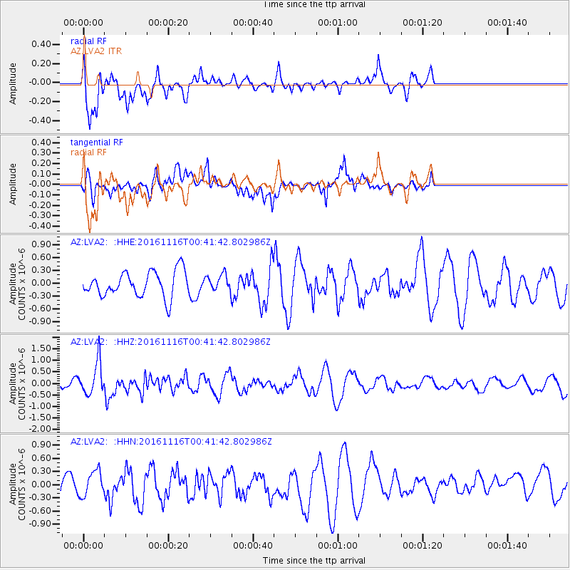
LVA2 AZ.LVA2 - Earthquake Result Viewer
*The percent match for this event was below the threshold and hence no stack was calculated.
| Earthquake location: |
Tonga Islands Region |
| Earthquake latitude/longitude: |
-20.2/-173.0 |
| Earthquake time(UTC): |
2016/11/16 (321) 00:30:28 GMT |
| Earthquake Depth: |
10 km |
| Earthquake Magnitude: |
5.9 MB, 5.6 MWB |
| Earthquake Catalog/Contributor: |
NEIC PDE/NEIC COMCAT |
|
| Network: |
AZ ANZA Regional Network |
| Station: |
LVA2 AZ.LVA2 |
| Lat/Lon: |
33.35 N/116.56 W |
| Elevation: |
1435 m |
|
| Distance: |
75.7 deg |
| Az: |
46.014 deg |
| Baz: |
233.844 deg |
| Ray Param: |
$rayparam |
*The percent match for this event was below the threshold and hence was not used in the summary stack. |
|
| Radial Match: |
69.47775 % |
| Radial Bump: |
400 |
| Transverse Match: |
61.17854 % |
| Transverse Bump: |
400 |
| SOD ConfigId: |
11737051 |
| Insert Time: |
2019-04-26 02:15:13.504 +0000 |
| GWidth: |
2.5 |
| Max Bumps: |
400 |
| Tol: |
0.001 |
|
Signal To Noise
| Channel | StoN | STA | LTA |
| AZ:LVA2: :HHZ:20161116T00:41:42.802986Z | 4.5002284 | 7.340164E-7 | 1.6310648E-7 |
| AZ:LVA2: :HHN:20161116T00:41:42.802986Z | 0.9098261 | 2.841298E-7 | 3.1229024E-7 |
| AZ:LVA2: :HHE:20161116T00:41:42.802986Z | 0.6160647 | 1.8375113E-7 | 2.9826592E-7 |
| Arrivals |
| Ps | |
| PpPs | |
| PsPs/PpSs | |


