You are here: Home > Network List > AZ - ANZA Regional Network Stations List
> Station SMER AZ.SMER > Earthquake Result Viewer
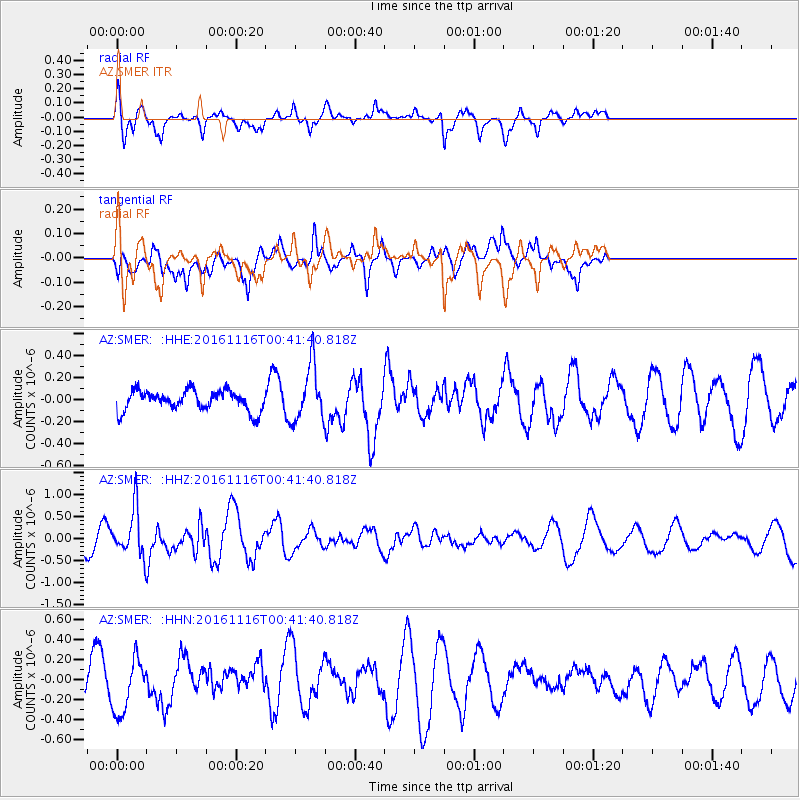
SMER AZ.SMER - Earthquake Result Viewer
*The percent match for this event was below the threshold and hence no stack was calculated.
| Earthquake location: |
Tonga Islands Region |
| Earthquake latitude/longitude: |
-20.2/-173.0 |
| Earthquake time(UTC): |
2016/11/16 (321) 00:30:28 GMT |
| Earthquake Depth: |
10 km |
| Earthquake Magnitude: |
5.9 MB, 5.6 MWB |
| Earthquake Catalog/Contributor: |
NEIC PDE/NEIC COMCAT |
|
| Network: |
AZ ANZA Regional Network |
| Station: |
SMER AZ.SMER |
| Lat/Lon: |
33.46 N/117.17 W |
| Elevation: |
355 m |
|
| Distance: |
75.3 deg |
| Az: |
45.613 deg |
| Baz: |
233.41 deg |
| Ray Param: |
$rayparam |
*The percent match for this event was below the threshold and hence was not used in the summary stack. |
|
| Radial Match: |
54.525646 % |
| Radial Bump: |
370 |
| Transverse Match: |
55.455307 % |
| Transverse Bump: |
400 |
| SOD ConfigId: |
11737051 |
| Insert Time: |
2019-04-26 02:15:17.471 +0000 |
| GWidth: |
2.5 |
| Max Bumps: |
400 |
| Tol: |
0.001 |
|
Signal To Noise
| Channel | StoN | STA | LTA |
| AZ:SMER: :HHZ:20161116T00:41:40.818Z | 2.4385052 | 5.292611E-7 | 2.1704325E-7 |
| AZ:SMER: :HHN:20161116T00:41:40.818Z | 1.4922988 | 2.5720527E-7 | 1.7235506E-7 |
| AZ:SMER: :HHE:20161116T00:41:40.818Z | 2.7279747 | 2.5246393E-7 | 9.254629E-8 |
| Arrivals |
| Ps | |
| PpPs | |
| PsPs/PpSs | |


