You are here: Home > Network List > CI - Caltech Regional Seismic Network Stations List
> Station SLA SLA, Trona, CA, USA > Earthquake Result Viewer
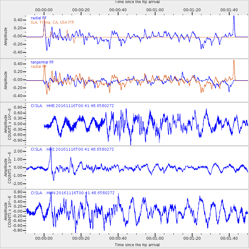
SLA SLA, Trona, CA, USA - Earthquake Result Viewer
*The percent match for this event was below the threshold and hence no stack was calculated.
| Earthquake location: |
Tonga Islands Region |
| Earthquake latitude/longitude: |
-20.2/-173.0 |
| Earthquake time(UTC): |
2016/11/16 (321) 00:30:28 GMT |
| Earthquake Depth: |
10 km |
| Earthquake Magnitude: |
5.9 MB, 5.6 MWB |
| Earthquake Catalog/Contributor: |
NEIC PDE/NEIC COMCAT |
|
| Network: |
CI Caltech Regional Seismic Network |
| Station: |
SLA SLA, Trona, CA, USA |
| Lat/Lon: |
35.89 N/117.28 W |
| Elevation: |
1174 m |
|
| Distance: |
76.7 deg |
| Az: |
43.555 deg |
| Baz: |
232.849 deg |
| Ray Param: |
$rayparam |
*The percent match for this event was below the threshold and hence was not used in the summary stack. |
|
| Radial Match: |
62.629604 % |
| Radial Bump: |
400 |
| Transverse Match: |
61.492256 % |
| Transverse Bump: |
400 |
| SOD ConfigId: |
11737051 |
| Insert Time: |
2019-04-26 02:16:39.958 +0000 |
| GWidth: |
2.5 |
| Max Bumps: |
400 |
| Tol: |
0.001 |
|
Signal To Noise
| Channel | StoN | STA | LTA |
| CI:SLA: :HHZ:20161116T00:41:48.658027Z | 4.5731115 | 8.064343E-7 | 1.763426E-7 |
| CI:SLA: :HHN:20161116T00:41:48.658027Z | 1.0663362 | 3.1562786E-7 | 2.9599283E-7 |
| CI:SLA: :HHE:20161116T00:41:48.658027Z | 1.0948952 | 2.8643018E-7 | 2.6160512E-7 |
| Arrivals |
| Ps | |
| PpPs | |
| PsPs/PpSs | |


