You are here: Home > Network List > CI - Caltech Regional Seismic Network Stations List
> Station SMM Simmler, CA, USA > Earthquake Result Viewer
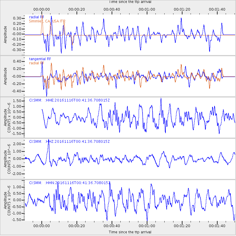
SMM Simmler, CA, USA - Earthquake Result Viewer
*The percent match for this event was below the threshold and hence no stack was calculated.
| Earthquake location: |
Tonga Islands Region |
| Earthquake latitude/longitude: |
-20.2/-173.0 |
| Earthquake time(UTC): |
2016/11/16 (321) 00:30:28 GMT |
| Earthquake Depth: |
10 km |
| Earthquake Magnitude: |
5.9 MB, 5.6 MWB |
| Earthquake Catalog/Contributor: |
NEIC PDE/NEIC COMCAT |
|
| Network: |
CI Caltech Regional Seismic Network |
| Station: |
SMM Simmler, CA, USA |
| Lat/Lon: |
35.31 N/120.00 W |
| Elevation: |
599 m |
|
| Distance: |
74.6 deg |
| Az: |
42.616 deg |
| Baz: |
231.045 deg |
| Ray Param: |
$rayparam |
*The percent match for this event was below the threshold and hence was not used in the summary stack. |
|
| Radial Match: |
58.37919 % |
| Radial Bump: |
400 |
| Transverse Match: |
51.672024 % |
| Transverse Bump: |
400 |
| SOD ConfigId: |
11737051 |
| Insert Time: |
2019-04-26 02:16:40.883 +0000 |
| GWidth: |
2.5 |
| Max Bumps: |
400 |
| Tol: |
0.001 |
|
Signal To Noise
| Channel | StoN | STA | LTA |
| CI:SMM: :HHZ:20161116T00:41:36.708015Z | 4.202231 | 9.487636E-7 | 2.2577618E-7 |
| CI:SMM: :HHN:20161116T00:41:36.708015Z | 0.99458426 | 2.55758E-7 | 2.5715067E-7 |
| CI:SMM: :HHE:20161116T00:41:36.708015Z | 1.9135994 | 7.236701E-7 | 3.781722E-7 |
| Arrivals |
| Ps | |
| PpPs | |
| PsPs/PpSs | |


