You are here: Home > Network List > CN - Canadian National Seismograph Network Stations List
> Station INK INUVIK, NT > Earthquake Result Viewer
INK INUVIK, NT - Earthquake Result Viewer
*The percent match for this event was below the threshold and hence no stack was calculated.
| Earthquake location: |
Tonga Islands Region |
| Earthquake latitude/longitude: |
-20.2/-173.0 |
| Earthquake time(UTC): |
2016/11/16 (321) 00:30:28 GMT |
| Earthquake Depth: |
10 km |
| Earthquake Magnitude: |
5.9 MB, 5.6 MWB |
| Earthquake Catalog/Contributor: |
NEIC PDE/NEIC COMCAT |
|
| Network: |
CN Canadian National Seismograph Network |
| Station: |
INK INUVIK, NT |
| Lat/Lon: |
68.31 N/133.53 W |
| Elevation: |
44 m |
|
| Distance: |
92.8 deg |
| Az: |
13.677 deg |
| Baz: |
216.681 deg |
| Ray Param: |
$rayparam |
*The percent match for this event was below the threshold and hence was not used in the summary stack. |
|
| Radial Match: |
58.92519 % |
| Radial Bump: |
400 |
| Transverse Match: |
56.66118 % |
| Transverse Bump: |
400 |
| SOD ConfigId: |
11737051 |
| Insert Time: |
2019-04-26 02:16:55.598 +0000 |
| GWidth: |
2.5 |
| Max Bumps: |
400 |
| Tol: |
0.001 |
|
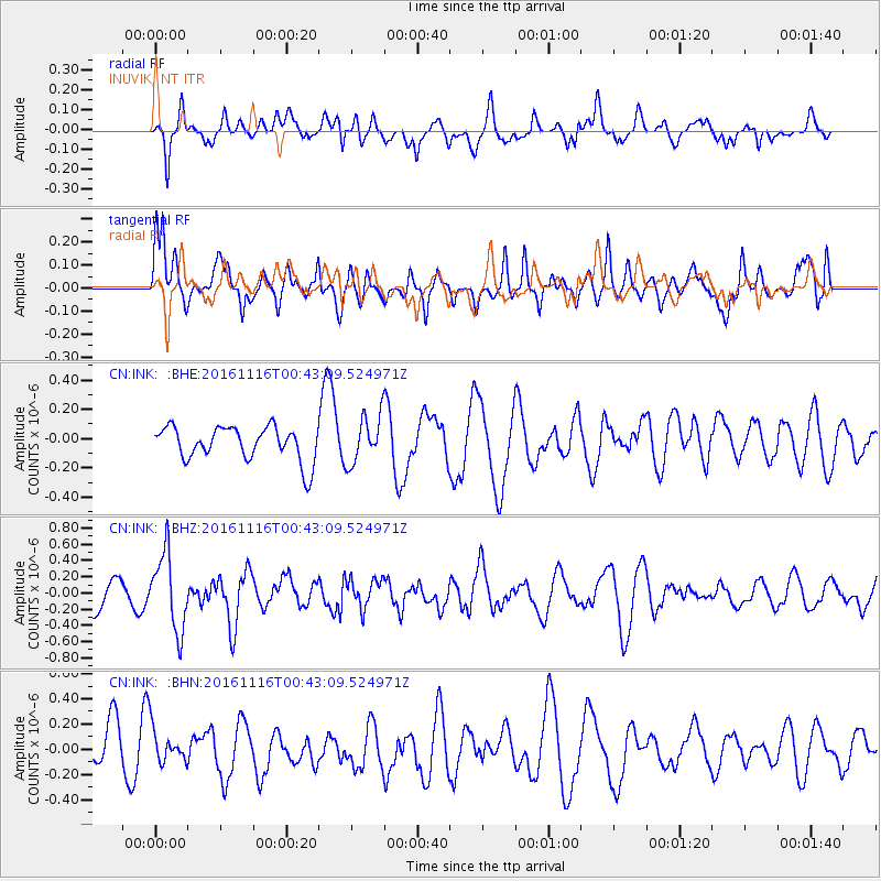
Signal To Noise
| Channel | StoN | STA | LTA |
| CN:INK: :BHZ:20161116T00:43:09.524971Z | 1.9159186 | 4.6764214E-7 | 2.4408246E-7 |
| CN:INK: :BHN:20161116T00:43:09.524971Z | 0.73864377 | 1.3023364E-7 | 1.7631456E-7 |
| CN:INK: :BHE:20161116T00:43:09.524971Z | 1.3680959 | 1.5752457E-7 | 1.1514147E-7 |
| Arrivals |
| Ps | |
| PpPs | |
| PsPs/PpSs | |


