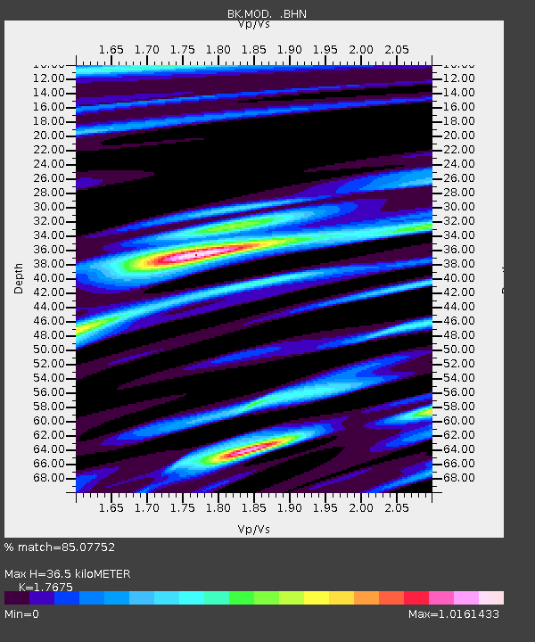
MOD Modoc Plateau, CA - Earthquake Result Viewer
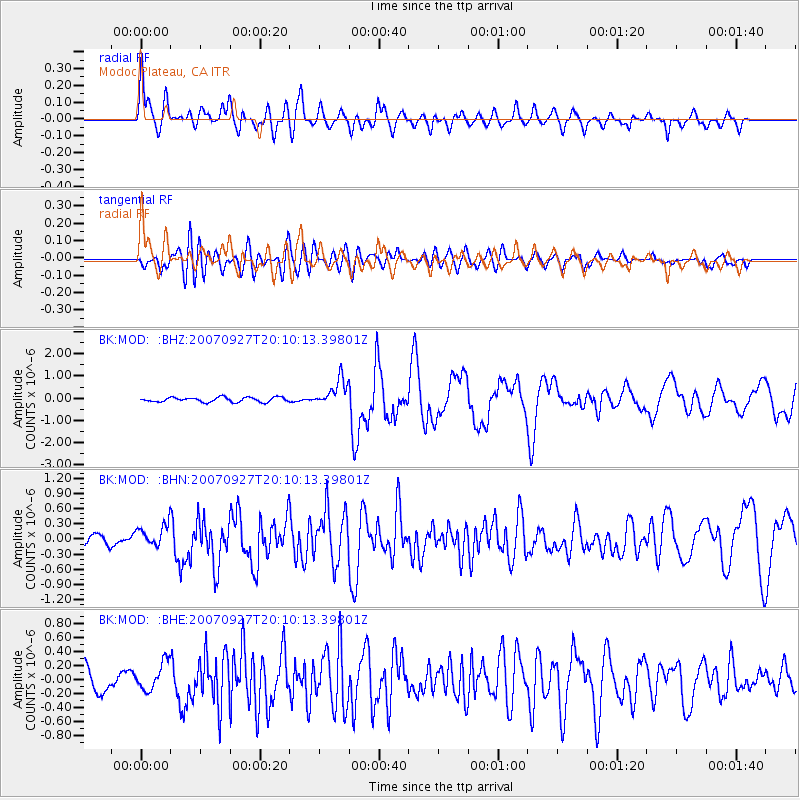
Earthquake location: Southeast Of Loyalty Islands
Earthquake latitude/longitude: -21.1/169.3
Earthquake time(UTC): 2007/09/27 (270) 19:57:44 GMT
Earthquake Depth: 9.0 km
Earthquake Magnitude: 6.2 MB, 6.3 MS, 6.1 MW, 6.1 MW
Earthquake Catalog/Contributor: WHDF/NEIC
Network: BK Berkeley Digital Seismograph Network
Station: MOD Modoc Plateau, CA
Lat/Lon: 41.90 N/120.30 W
Elevation: 1554 m
Distance: 90.3 deg
Az: 44.694 deg
Baz: 241.609 deg
Ray Param: 0.041686367
Estimated Moho Depth: 36.5 km
Estimated Crust Vp/Vs: 1.77
Assumed Crust Vp: 6.566 km/s
Estimated Crust Vs: 3.715 km/s
Estimated Crust Poisson's Ratio: 0.26
Radial Match: 85.07752 %
Radial Bump: 400
Transverse Match: 64.58818 %
Transverse Bump: 400
SOD ConfigId: 2564
Insert Time: 2010-03-05 19:40:32.987 +0000
GWidth: 2.5
Max Bumps: 400
Tol: 0.001

Signal To Noise

ChannelStoNSTALTA
BK:MOD: :BHN:20070927T20:10:13.39801Z2.42741322.2267939E-79.173527E-8
BK:MOD: :BHE:20070927T20:10:13.39801Z1.50431692.0005224E-71.3298543E-7
BK:MOD: :BHZ:20070927T20:10:13.39801Z5.741666.049899E-71.0536847E-7
Arrivals
Ps4.4 SECOND
PpPs15 SECOND
PsPs/PpSs19 SECOND