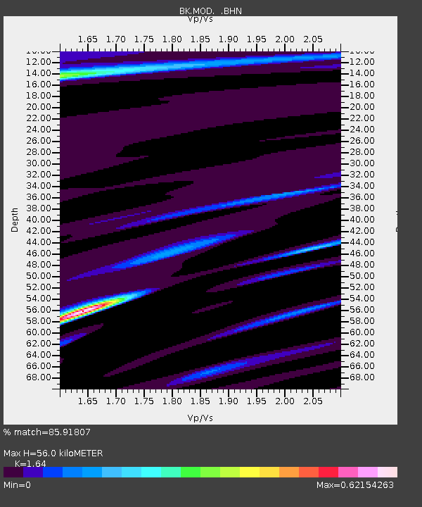
MOD Modoc Plateau, CA - Earthquake Result Viewer
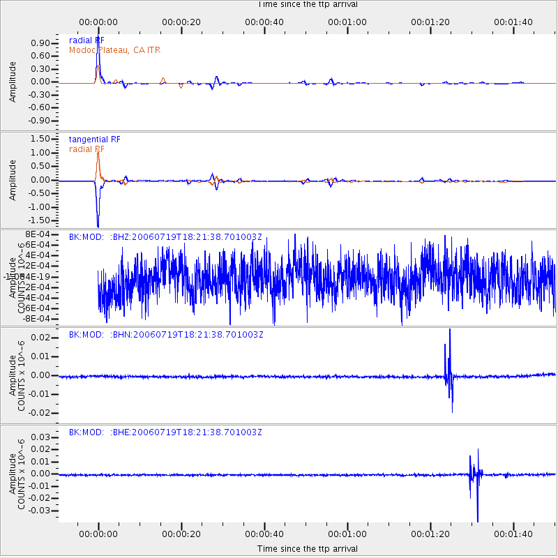
Earthquake location: New Britain Region, P.N.G.
Earthquake latitude/longitude: -5.3/150.7
Earthquake time(UTC): 2006/07/19 (200) 18:08:57 GMT
Earthquake Depth: 10 km
Earthquake Magnitude: 5.7 MB, 5.7 MS, 5.9 MW, 5.6 MW
Earthquake Catalog/Contributor: WHDF/NEIC
Network: BK Berkeley Digital Seismograph Network
Station: MOD Modoc Plateau, CA
Lat/Lon: 41.90 N/120.30 W
Elevation: 1554 m
Distance: 92.8 deg
Az: 48.355 deg
Baz: 265.386 deg
Ray Param: 0.04139108
Estimated Moho Depth: 56.0 km
Estimated Crust Vp/Vs: 1.64
Assumed Crust Vp: 6.566 km/s
Estimated Crust Vs: 4.004 km/s
Estimated Crust Poisson's Ratio: 0.20
Radial Match: 85.91807 %
Radial Bump: 162
Transverse Match: 80.12596 %
Transverse Bump: 170
SOD ConfigId: 2665
Insert Time: 2010-03-05 19:40:47.129 +0000
GWidth: 2.5
Max Bumps: 400
Tol: 0.001

Signal To Noise

ChannelStoNSTALTA
BK:MOD: :BHN:20060719T18:21:38.701003Z1.4528724.0941905E-102.817998E-10
BK:MOD: :BHE:20060719T18:21:38.701003Z0.981977343.27908E-103.3392622E-10
BK:MOD: :BHZ:20060719T18:21:38.701003Z0.984984462.9132824E-102.9576938E-10
Arrivals
Ps5.6 SECOND
PpPs22 SECOND
PsPs/PpSs28 SECOND