MOD Modoc Plateau, CA - Earthquake Result Viewer
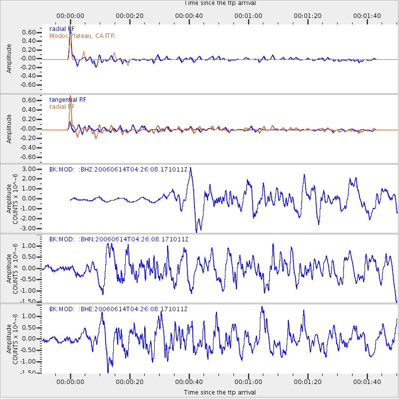
Earthquake location: Rat Islands, Aleutian Islands
Earthquake latitude/longitude: 51.8/177.1
Earthquake time(UTC): 2006/06/14 (165) 04:18:42 GMT
Earthquake Depth: 14 km
Earthquake Magnitude: 5.9 MB, 6.4 MS, 6.4 MW, 6.4 MW
Earthquake Catalog/Contributor: WHDF/NEIC
Network: BK Berkeley Digital Seismograph Network
Station: MOD Modoc Plateau, CA
Lat/Lon: 41.90 N/120.30 W
Elevation: 1554 m
Distance: 42.7 deg
Az: 77.689 deg
Baz: 305.554 deg
Ray Param: 0.07299555
Estimated Moho Depth: 37.25 km
Estimated Crust Vp/Vs: 1.63
Assumed Crust Vp: 6.566 km/s
Estimated Crust Vs: 4.016 km/s
Estimated Crust Poisson's Ratio: 0.20
Radial Match: 92.12871 %
Radial Bump: 334
Transverse Match: 58.25173 %
Transverse Bump: 400
SOD ConfigId: 5745
Insert Time: 2010-03-05 19:40:49.230 +0000
GWidth: 2.5
Max Bumps: 400
Tol: 0.001

Signal To Noise

ChannelStoNSTALTA
BK:MOD: :BHN:20060614T04:26:08.171011Z3.0201382.1450617E-77.102529E-8
BK:MOD: :BHE:20060614T04:26:08.171011Z1.61125361.7784731E-71.10378224E-7
BK:MOD: :BHZ:20060614T04:26:08.171011Z3.48696474.8153623E-71.3809611E-7
Arrivals
Ps3.9 SECOND
PpPs14 SECOND
PsPs/PpSs18 SECOND