You are here: Home > Network List > TA - USArray Transportable Network (new EarthScope stations) Stations List
> Station G22K Bettles, AK, USA > Earthquake Result Viewer
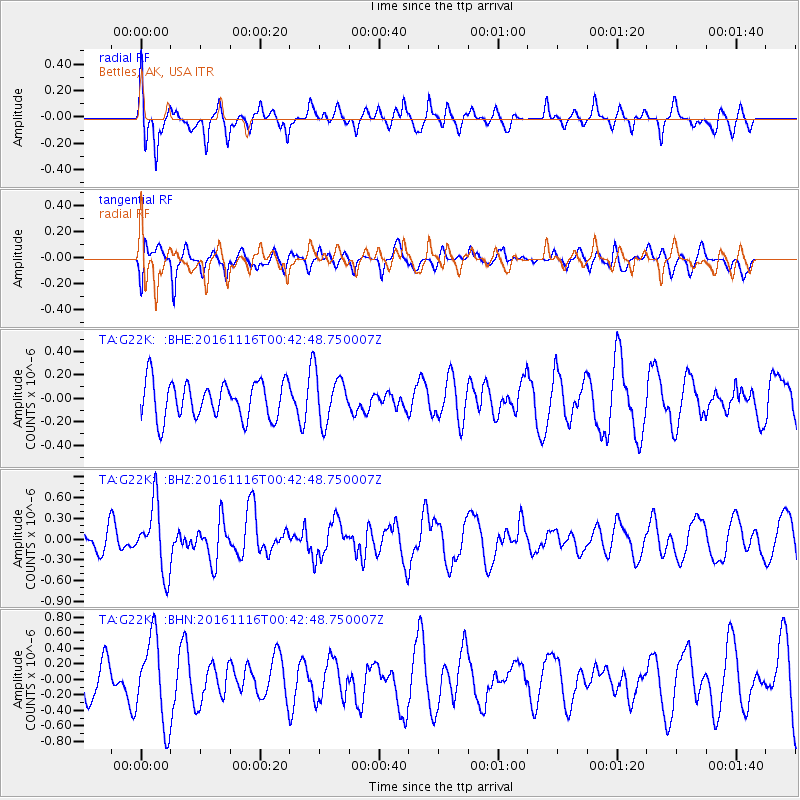
G22K Bettles, AK, USA - Earthquake Result Viewer
*The percent match for this event was below the threshold and hence no stack was calculated.
| Earthquake location: |
Tonga Islands Region |
| Earthquake latitude/longitude: |
-20.2/-173.0 |
| Earthquake time(UTC): |
2016/11/16 (321) 00:30:28 GMT |
| Earthquake Depth: |
10 km |
| Earthquake Magnitude: |
5.9 MB, 5.6 MWB |
| Earthquake Catalog/Contributor: |
NEIC PDE/NEIC COMCAT |
|
| Network: |
TA USArray Transportable Network (new EarthScope stations) |
| Station: |
G22K Bettles, AK, USA |
| Lat/Lon: |
66.92 N/151.51 W |
| Elevation: |
205 m |
|
| Distance: |
88.3 deg |
| Az: |
8.294 deg |
| Baz: |
200.103 deg |
| Ray Param: |
$rayparam |
*The percent match for this event was below the threshold and hence was not used in the summary stack. |
|
| Radial Match: |
65.55736 % |
| Radial Bump: |
400 |
| Transverse Match: |
64.00411 % |
| Transverse Bump: |
399 |
| SOD ConfigId: |
11737051 |
| Insert Time: |
2019-04-26 02:20:37.978 +0000 |
| GWidth: |
2.5 |
| Max Bumps: |
400 |
| Tol: |
0.001 |
|
Signal To Noise
| Channel | StoN | STA | LTA |
| TA:G22K: :BHZ:20161116T00:42:48.750007Z | 2.0968034 | 4.8727634E-7 | 2.3239011E-7 |
| TA:G22K: :BHN:20161116T00:42:48.750007Z | 1.7605975 | 5.5223603E-7 | 3.13664E-7 |
| TA:G22K: :BHE:20161116T00:42:48.750007Z | 1.3540217 | 2.1095656E-7 | 1.5579998E-7 |
| Arrivals |
| Ps | |
| PpPs | |
| PsPs/PpSs | |


