
MOD Modoc Plateau, CA - Earthquake Result Viewer
| ||||||||||||||||||
| ||||||||||||||||||
| ||||||||||||||||||
|
Signal To Noise
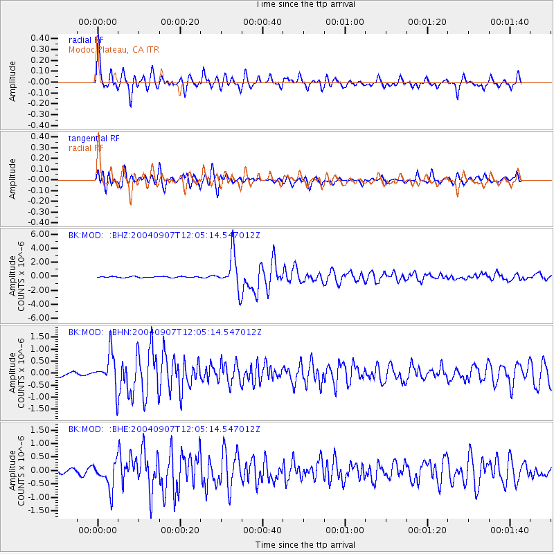
| Channel | StoN | STA | LTA |
| BK:MOD: :BHN:20040907T12:05:14.547012Z | 8.32432 | 7.4063826E-7 | 8.897283E-8 |
| BK:MOD: :BHE:20040907T12:05:14.547012Z | 4.273456 | 5.1909325E-7 | 1.2146918E-7 |
| BK:MOD: :BHZ:20040907T12:05:14.547012Z | 36.55816 | 2.5928578E-6 | 7.092418E-8 |
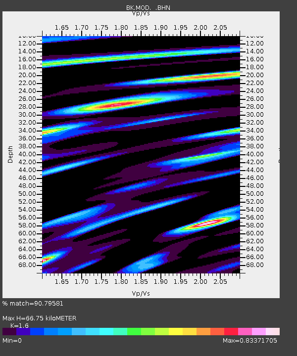
| Arrivals | |
| Ps | 6.3 SECOND |
| PpPs | 26 SECOND |
| PsPs/PpSs | 32 SECOND |

