
MOD Modoc Plateau, CA - Earthquake Result Viewer
| ||||||||||||||||||
| ||||||||||||||||||
| ||||||||||||||||||
|
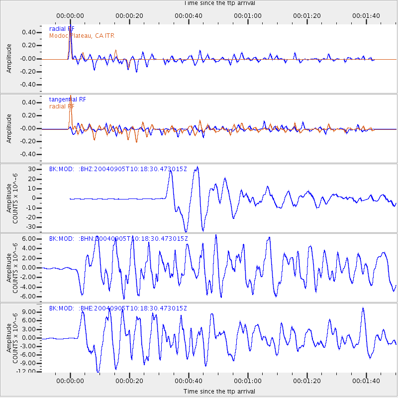
Signal To Noise
| Channel | StoN | STA | LTA |
| BK:MOD: :BHN:20040905T10:18:30.473015Z | 24.118546 | 2.5097397E-6 | 1.040585E-7 |
| BK:MOD: :BHE:20040905T10:18:30.473015Z | 29.404047 | 4.266024E-6 | 1.4508288E-7 |
| BK:MOD: :BHZ:20040905T10:18:30.473015Z | 149.40912 | 1.3326074E-5 | 8.9191836E-8 |
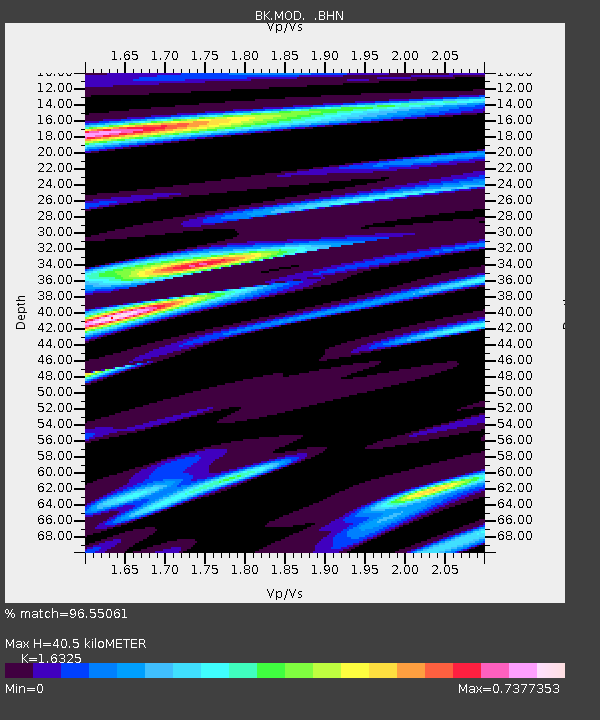
| Arrivals | |
| Ps | 4.0 SECOND |
| PpPs | 16 SECOND |
| PsPs/PpSs | 20 SECOND |

