MOD Modoc Plateau, CA - Earthquake Result Viewer
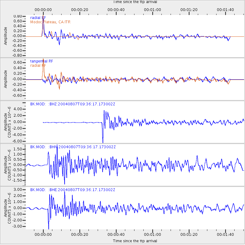
Earthquake location: South Of Aleutian Islands
Earthquake latitude/longitude: 51.8/-166.3
Earthquake time(UTC): 2004/08/07 (220) 09:30:16 GMT
Earthquake Depth: 8.0 km
Earthquake Magnitude: 6.3 MB, 5.4 MS, 6.0 MW, 6.0 MW
Earthquake Catalog/Contributor: WHDF/NEIC
Network: BK Berkeley Digital Seismograph Network
Station: MOD Modoc Plateau, CA
Lat/Lon: 41.90 N/120.30 W
Elevation: 1554 m
Distance: 32.5 deg
Az: 89.202 deg
Baz: 303.631 deg
Ray Param: 0.07863403
Estimated Moho Depth: 19.5 km
Estimated Crust Vp/Vs: 1.60
Assumed Crust Vp: 6.566 km/s
Estimated Crust Vs: 4.097 km/s
Estimated Crust Poisson's Ratio: 0.18
Radial Match: 87.58362 %
Radial Bump: 400
Transverse Match: 68.67897 %
Transverse Bump: 400
SOD ConfigId: 2459
Insert Time: 2010-03-05 19:41:55.134 +0000
GWidth: 2.5
Max Bumps: 400
Tol: 0.001

Signal To Noise

ChannelStoNSTALTA
BK:MOD: :BHN:20040807T09:36:17.173002Z5.5824234.855438E-78.697725E-8
BK:MOD: :BHE:20040807T09:36:17.173002Z11.804851.1288087E-69.562245E-8
BK:MOD: :BHZ:20040807T09:36:17.173002Z36.017562.0242908E-65.620289E-8
Arrivals
Ps2.0 SECOND
PpPs7.0 SECOND
PsPs/PpSs9.0 SECOND