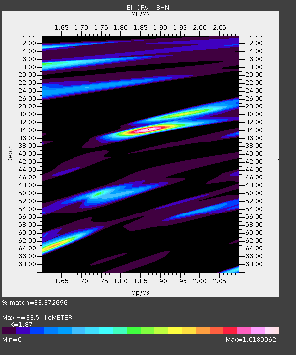
ORV Oroville Dam, CA - Earthquake Result Viewer
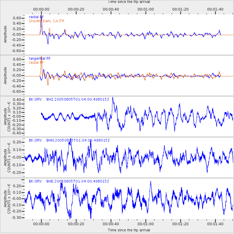
Earthquake location: Andreanof Islands, Aleutian Is.
Earthquake latitude/longitude: 51.2/-178.3
Earthquake time(UTC): 2005/08/05 (217) 00:56:53 GMT
Earthquake Depth: 23 km
Earthquake Magnitude: 5.6 MB, 5.3 MS, 5.8 MW, 5.7 MW
Earthquake Catalog/Contributor: WHDF/NEIC
Network: BK Berkeley Digital Seismograph Network
Station: ORV Oroville Dam, CA
Lat/Lon: 39.55 N/121.50 W
Elevation: 335 m
Distance: 40.6 deg
Az: 83.896 deg
Baz: 306.043 deg
Ray Param: 0.07429467
Estimated Moho Depth: 33.5 km
Estimated Crust Vp/Vs: 1.87
Assumed Crust Vp: 6.597 km/s
Estimated Crust Vs: 3.528 km/s
Estimated Crust Poisson's Ratio: 0.30
Radial Match: 83.372696 %
Radial Bump: 394
Transverse Match: 66.89069 %
Transverse Bump: 400
SOD ConfigId: 124340
Insert Time: 2010-03-05 19:42:06.656 +0000
GWidth: 2.5
Max Bumps: 400
Tol: 0.001

Signal To Noise

ChannelStoNSTALTA
BK:ORV: :BHN:20050805T01:04:00.498015Z1.89502785.2188483E-82.7539693E-8
BK:ORV: :BHE:20050805T01:04:00.498015Z1.25095686.4353515E-85.1443436E-8
BK:ORV: :BHZ:20050805T01:04:00.498015Z1.94614929.3822216E-84.8209156E-8
Arrivals
Ps4.7 SECOND
PpPs14 SECOND
PsPs/PpSs18 SECOND