You are here: Home > Network List > US - United States National Seismic Network Stations List
> Station AMTX Amarillo, Texas, USA > Earthquake Result Viewer
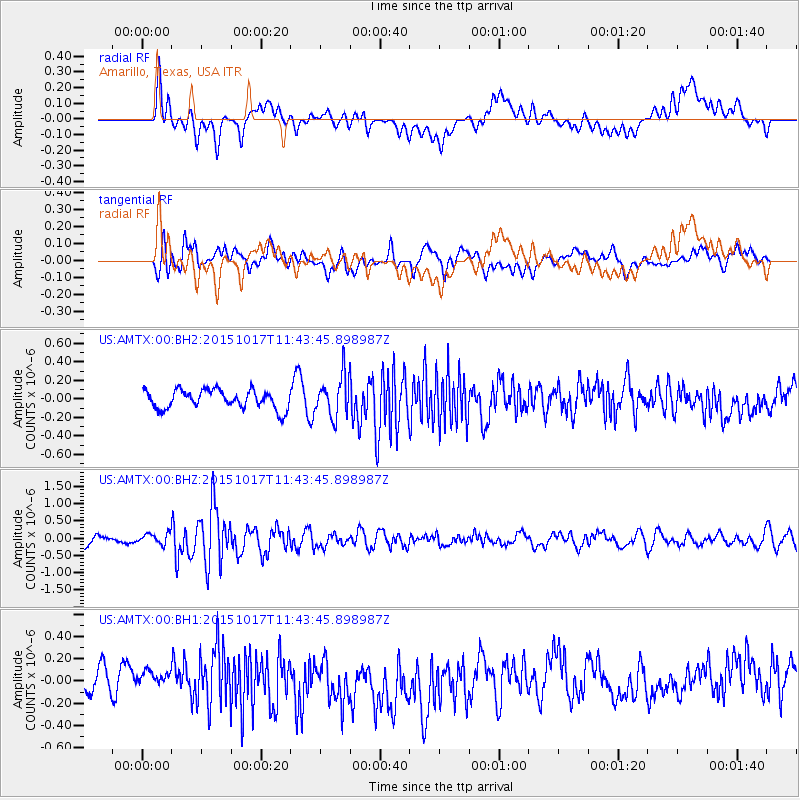
AMTX Amarillo, Texas, USA - Earthquake Result Viewer
*The percent match for this event was below the threshold and hence no stack was calculated.
| Earthquake location: |
Salta Province, Argentina |
| Earthquake latitude/longitude: |
-25.4/-64.4 |
| Earthquake time(UTC): |
2015/10/17 (290) 11:33:07 GMT |
| Earthquake Depth: |
8.2 km |
| Earthquake Magnitude: |
6.0 MB, 5.9 MWB |
| Earthquake Catalog/Contributor: |
NEIC PDE/NEIC COMCAT |
|
| Network: |
US United States National Seismic Network |
| Station: |
AMTX Amarillo, Texas, USA |
| Lat/Lon: |
34.53 N/101.41 W |
| Elevation: |
1010 m |
|
| Distance: |
69.2 deg |
| Az: |
327.908 deg |
| Baz: |
144.41 deg |
| Ray Param: |
$rayparam |
*The percent match for this event was below the threshold and hence was not used in the summary stack. |
|
| Radial Match: |
48.528156 % |
| Radial Bump: |
400 |
| Transverse Match: |
59.849045 % |
| Transverse Bump: |
400 |
| SOD ConfigId: |
1259291 |
| Insert Time: |
2015-10-31 12:07:53.067 +0000 |
| GWidth: |
2.5 |
| Max Bumps: |
400 |
| Tol: |
0.001 |
|
Signal To Noise
| Channel | StoN | STA | LTA |
| US:AMTX:00:BHZ:20151017T11:43:45.898987Z | 1.1348542 | 1.770194E-7 | 1.5598425E-7 |
| US:AMTX:00:BH1:20151017T11:43:45.898987Z | 1.1831951 | 1.3870235E-7 | 1.17226946E-7 |
| US:AMTX:00:BH2:20151017T11:43:45.898987Z | 2.2009058 | 1.8822836E-7 | 8.552313E-8 |
| Arrivals |
| Ps | |
| PpPs | |
| PsPs/PpSs | |


