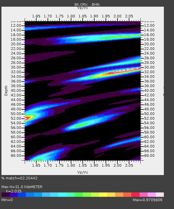
ORV Oroville Dam, CA - Earthquake Result Viewer

Earthquake location: Bonin Islands, Japan Region
Earthquake latitude/longitude: 26.1/144.0
Earthquake time(UTC): 2005/02/09 (040) 18:46:09 GMT
Earthquake Depth: 24 km
Earthquake Magnitude: 6.2 MB, 6.3 MS, 6.3 MW, 6.3 MW
Earthquake Catalog/Contributor: WHDF/NEIC
Network: BK Berkeley Digital Seismograph Network
Station: ORV Oroville Dam, CA
Lat/Lon: 39.55 N/121.50 W
Elevation: 335 m
Distance: 77.1 deg
Az: 52.242 deg
Baz: 293.128 deg
Ray Param: 0.050507233
Estimated Moho Depth: 31.0 km
Estimated Crust Vp/Vs: 2.04
Assumed Crust Vp: 6.597 km/s
Estimated Crust Vs: 3.242 km/s
Estimated Crust Poisson's Ratio: 0.34
Radial Match: 82.20442 %
Radial Bump: 400
Transverse Match: 79.84299 %
Transverse Bump: 400
SOD ConfigId: 5233
Insert Time: 2010-03-05 19:42:44.834 +0000
GWidth: 2.5
Max Bumps: 400
Tol: 0.001

Signal To Noise

ChannelStoNSTALTA
BK:ORV: :BHN:20050209T18:57:30.123015Z1.61473582.4741786E-71.5322497E-7
BK:ORV: :BHE:20050209T18:57:30.123015Z1.76080694.5261794E-72.5705143E-7
BK:ORV: :BHZ:20050209T18:57:30.123015Z5.9646758.613966E-71.4441635E-7
Arrivals
Ps5.0 SECOND
PpPs14 SECOND
PsPs/PpSs19 SECOND