You are here: Home > Network List > TA - USArray Transportable Network (new EarthScope stations) Stations List
> Station 435B Jarrell, TX, USA > Earthquake Result Viewer
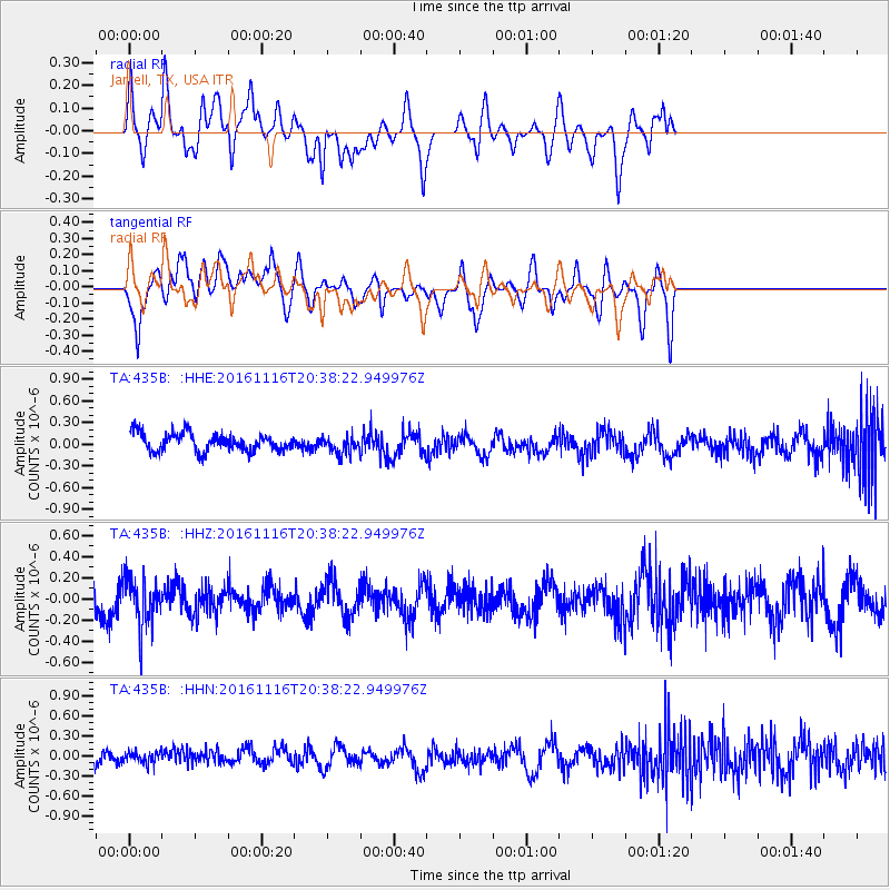
435B Jarrell, TX, USA - Earthquake Result Viewer
*The percent match for this event was below the threshold and hence no stack was calculated.
| Earthquake location: |
South Of Fiji Islands |
| Earthquake latitude/longitude: |
-22.1/-177.6 |
| Earthquake time(UTC): |
2016/11/16 (321) 20:26:15 GMT |
| Earthquake Depth: |
305 km |
| Earthquake Magnitude: |
5.5 MB |
| Earthquake Catalog/Contributor: |
NEIC PDE/NEIC COMCAT |
|
| Network: |
TA USArray Transportable Network (new EarthScope stations) |
| Station: |
435B Jarrell, TX, USA |
| Lat/Lon: |
30.78 N/97.58 W |
| Elevation: |
248 m |
|
| Distance: |
93.0 deg |
| Az: |
58.083 deg |
| Baz: |
246.133 deg |
| Ray Param: |
$rayparam |
*The percent match for this event was below the threshold and hence was not used in the summary stack. |
|
| Radial Match: |
61.267647 % |
| Radial Bump: |
400 |
| Transverse Match: |
62.349033 % |
| Transverse Bump: |
400 |
| SOD ConfigId: |
11737051 |
| Insert Time: |
2019-04-26 02:32:33.304 +0000 |
| GWidth: |
2.5 |
| Max Bumps: |
400 |
| Tol: |
0.001 |
|
Signal To Noise
| Channel | StoN | STA | LTA |
| TA:435B: :HHZ:20161116T20:38:22.949976Z | 1.7478535 | 2.2941447E-7 | 1.3125498E-7 |
| TA:435B: :HHN:20161116T20:38:22.949976Z | 0.73896337 | 9.0933504E-8 | 1.230555E-7 |
| TA:435B: :HHE:20161116T20:38:22.949976Z | 1.0716335 | 1.3183158E-7 | 1.2301929E-7 |
| Arrivals |
| Ps | |
| PpPs | |
| PsPs/PpSs | |


