You are here: Home > Network List > TA - USArray Transportable Network (new EarthScope stations) Stations List
> Station G22K Bettles, AK, USA > Earthquake Result Viewer
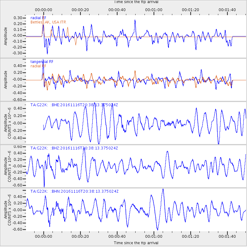
G22K Bettles, AK, USA - Earthquake Result Viewer
*The percent match for this event was below the threshold and hence no stack was calculated.
| Earthquake location: |
South Of Fiji Islands |
| Earthquake latitude/longitude: |
-22.1/-177.6 |
| Earthquake time(UTC): |
2016/11/16 (321) 20:26:15 GMT |
| Earthquake Depth: |
305 km |
| Earthquake Magnitude: |
5.5 MB |
| Earthquake Catalog/Contributor: |
NEIC PDE/NEIC COMCAT |
|
| Network: |
TA USArray Transportable Network (new EarthScope stations) |
| Station: |
G22K Bettles, AK, USA |
| Lat/Lon: |
66.92 N/151.51 W |
| Elevation: |
205 m |
|
| Distance: |
90.9 deg |
| Az: |
9.994 deg |
| Baz: |
204.09 deg |
| Ray Param: |
$rayparam |
*The percent match for this event was below the threshold and hence was not used in the summary stack. |
|
| Radial Match: |
36.825207 % |
| Radial Bump: |
288 |
| Transverse Match: |
59.114273 % |
| Transverse Bump: |
400 |
| SOD ConfigId: |
11737051 |
| Insert Time: |
2019-04-26 02:32:37.270 +0000 |
| GWidth: |
2.5 |
| Max Bumps: |
400 |
| Tol: |
0.001 |
|
Signal To Noise
| Channel | StoN | STA | LTA |
| TA:G22K: :BHZ:20161116T20:38:13.375024Z | 1.4043822 | 2.2231526E-7 | 1.583011E-7 |
| TA:G22K: :BHN:20161116T20:38:13.375024Z | 0.9428723 | 2.415709E-7 | 2.5620741E-7 |
| TA:G22K: :BHE:20161116T20:38:13.375024Z | 1.8257676 | 3.629045E-7 | 1.9876816E-7 |
| Arrivals |
| Ps | |
| PpPs | |
| PsPs/PpSs | |


