
ORV Oroville Dam, CA - Earthquake Result Viewer

| ||||||||||||||||||
| ||||||||||||||||||
| ||||||||||||||||||
|
Signal To Noise
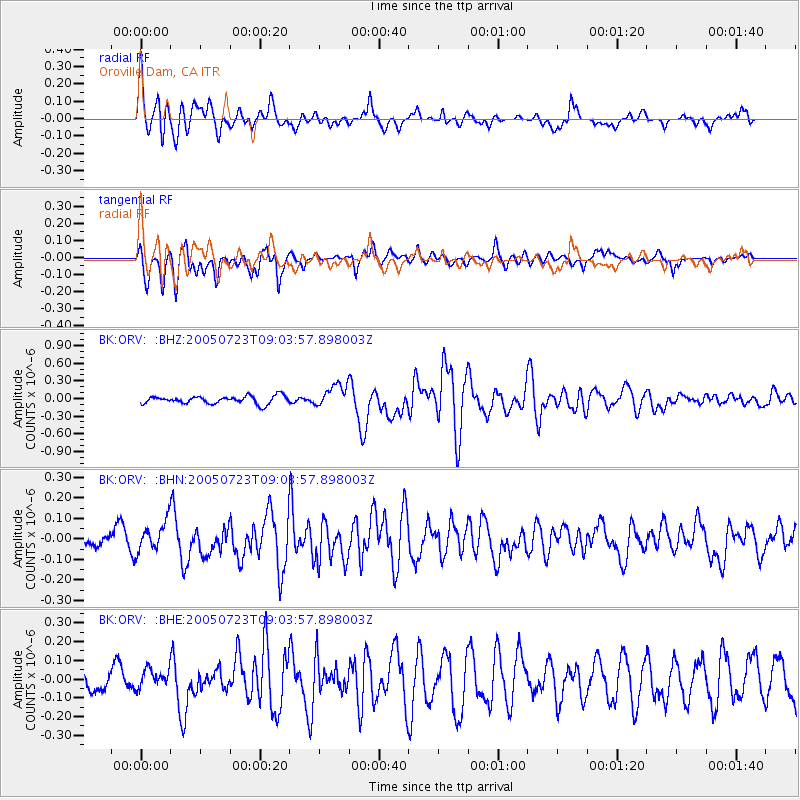
| Channel | StoN | STA | LTA |
| BK:ORV: :BHN:20050723T09:03:57.898003Z | 1.7871742 | 7.186624E-8 | 4.0212218E-8 |
| BK:ORV: :BHE:20050723T09:03:57.898003Z | 0.94235325 | 5.1286534E-8 | 5.4423897E-8 |
| BK:ORV: :BHZ:20050723T09:03:57.898003Z | 2.993024 | 1.9438122E-7 | 6.494476E-8 |
| Arrivals | |
| Ps | 2.9 SECOND |
| PpPs | 10 SECOND |
| PsPs/PpSs | 13 SECOND |

