You are here: Home > Network List > TA - USArray Transportable Network (new EarthScope stations) Stations List
> Station P17K Kvichak River, AK, USA > Earthquake Result Viewer
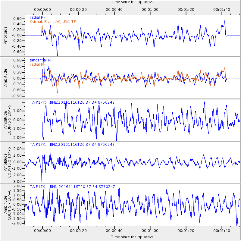
P17K Kvichak River, AK, USA - Earthquake Result Viewer
*The percent match for this event was below the threshold and hence no stack was calculated.
| Earthquake location: |
South Of Fiji Islands |
| Earthquake latitude/longitude: |
-22.1/-177.6 |
| Earthquake time(UTC): |
2016/11/16 (321) 20:26:15 GMT |
| Earthquake Depth: |
305 km |
| Earthquake Magnitude: |
5.5 MB |
| Earthquake Catalog/Contributor: |
NEIC PDE/NEIC COMCAT |
|
| Network: |
TA USArray Transportable Network (new EarthScope stations) |
| Station: |
P17K Kvichak River, AK, USA |
| Lat/Lon: |
59.20 N/156.44 W |
| Elevation: |
91 m |
|
| Distance: |
82.9 deg |
| Az: |
10.801 deg |
| Baz: |
199.732 deg |
| Ray Param: |
$rayparam |
*The percent match for this event was below the threshold and hence was not used in the summary stack. |
|
| Radial Match: |
62.247066 % |
| Radial Bump: |
400 |
| Transverse Match: |
60.182377 % |
| Transverse Bump: |
400 |
| SOD ConfigId: |
11737051 |
| Insert Time: |
2019-04-26 02:32:59.639 +0000 |
| GWidth: |
2.5 |
| Max Bumps: |
400 |
| Tol: |
0.001 |
|
Signal To Noise
| Channel | StoN | STA | LTA |
| TA:P17K: :BHZ:20161116T20:37:34.875024Z | 1.7341852 | 9.3041666E-7 | 5.3651513E-7 |
| TA:P17K: :BHN:20161116T20:37:34.875024Z | 0.9147927 | 7.3265795E-7 | 8.009005E-7 |
| TA:P17K: :BHE:20161116T20:37:34.875024Z | 1.198524 | 1.0367477E-6 | 8.650204E-7 |
| Arrivals |
| Ps | |
| PpPs | |
| PsPs/PpSs | |


