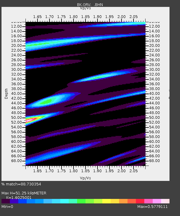
ORV Oroville Dam, CA - Earthquake Result Viewer
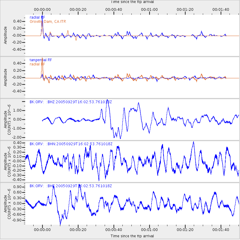
Earthquake location: New Britain Region, P.N.G.
Earthquake latitude/longitude: -5.4/151.8
Earthquake time(UTC): 2005/09/29 (272) 15:50:24 GMT
Earthquake Depth: 25 km
Earthquake Magnitude: 5.9 MB, 6.6 MS, 6.7 MW, 6.5 MW
Earthquake Catalog/Contributor: WHDF/NEIC
Network: BK Berkeley Digital Seismograph Network
Station: ORV Oroville Dam, CA
Lat/Lon: 39.55 N/121.50 W
Elevation: 335 m
Distance: 90.9 deg
Az: 50.523 deg
Baz: 263.709 deg
Ray Param: 0.041641407
Estimated Moho Depth: 51.25 km
Estimated Crust Vp/Vs: 1.60
Assumed Crust Vp: 6.597 km/s
Estimated Crust Vs: 4.117 km/s
Estimated Crust Poisson's Ratio: 0.18
Radial Match: 88.730354 %
Radial Bump: 315
Transverse Match: 81.43671 %
Transverse Bump: 400
SOD ConfigId: 2475
Insert Time: 2010-03-05 19:43:21.392 +0000
GWidth: 2.5
Max Bumps: 400
Tol: 0.001

Signal To Noise

ChannelStoNSTALTA
BK:ORV: :BHN:20050929T16:02:53.761018Z2.09269861.3690503E-76.542032E-8
BK:ORV: :BHE:20050929T16:02:53.761018Z1.03515081.5155875E-71.4641225E-7
BK:ORV: :BHZ:20050929T16:02:53.761018Z2.52314264.5480536E-71.8025354E-7
Arrivals
Ps4.8 SECOND
PpPs20 SECOND
PsPs/PpSs25 SECOND