You are here: Home > Network List > BK - Berkeley Digital Seismograph Network Stations List
> Station ORV Oroville Dam, CA > Earthquake Result Viewer
ORV Oroville Dam, CA - Earthquake Result Viewer

| Earthquake location: |
Easter Island Region |
| Earthquake latitude/longitude: |
-26.6/-114.5 |
| Earthquake time(UTC): |
2005/08/04 (216) 10:27:12 GMT |
| Earthquake Depth: |
10 km |
| Earthquake Magnitude: |
5.9 MB, 5.4 MS, 5.8 MW, 5.8 MW |
| Earthquake Catalog/Contributor: |
WHDF/NEIC |
|
| Network: |
BK Berkeley Digital Seismograph Network |
| Station: |
ORV Oroville Dam, CA |
| Lat/Lon: |
39.55 N/121.50 W |
| Elevation: |
335 m |
|
| Distance: |
66.2 deg |
| Az: |
354.091 deg |
| Baz: |
173.155 deg |
| Ray Param: |
0.05779242 |
| Estimated Moho Depth: |
53.75 km |
| Estimated Crust Vp/Vs: |
1.84 |
| Assumed Crust Vp: |
6.597 km/s |
| Estimated Crust Vs: |
3.581 km/s |
| Estimated Crust Poisson's Ratio: |
0.29 |
|
| Radial Match: |
80.25593 % |
| Radial Bump: |
400 |
| Transverse Match: |
73.17833 % |
| Transverse Bump: |
400 |
| SOD ConfigId: |
2500 |
| Insert Time: |
2010-03-05 19:43:22.767 +0000 |
| GWidth: |
2.5 |
| Max Bumps: |
400 |
| Tol: |
0.001 |
|
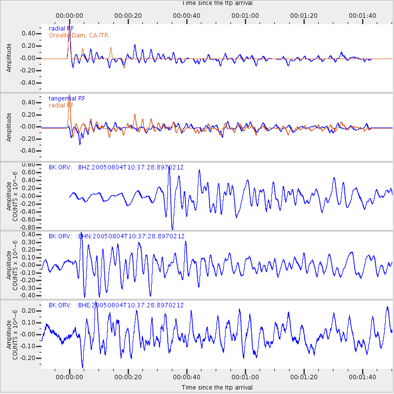
Signal To Noise
| Channel | StoN | STA | LTA |
| BK:ORV: :BHN:20050804T10:37:28.897021Z | 2.5348623 | 1.5699128E-7 | 6.1932866E-8 |
| BK:ORV: :BHE:20050804T10:37:28.897021Z | 1.8518381 | 9.251925E-8 | 4.9960768E-8 |
| BK:ORV: :BHZ:20050804T10:37:28.897021Z | 3.7042537 | 3.2350556E-7 | 8.733353E-8 |
| Arrivals |
| Ps | 7.2 SECOND |
| PpPs | 22 SECOND |
| PsPs/PpSs | 29 SECOND |


