ORV Oroville Dam, CA - Earthquake Result Viewer
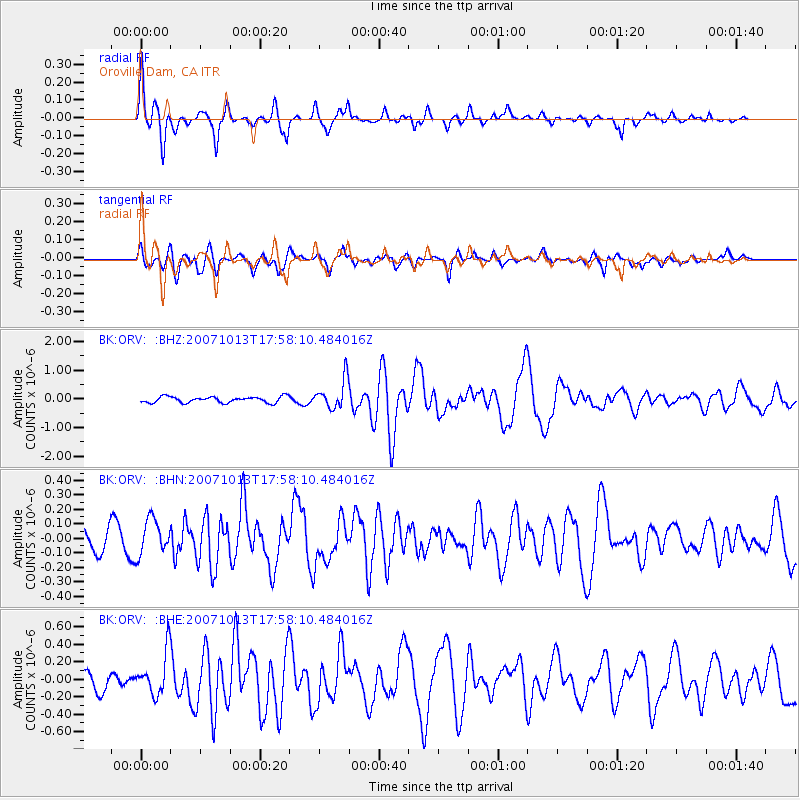
Earthquake location: Southeast Of Loyalty Islands
Earthquake latitude/longitude: -21.2/169.2
Earthquake time(UTC): 2007/10/13 (286) 17:45:53 GMT
Earthquake Depth: 37 km
Earthquake Magnitude: 5.8 MB, 5.9 MS, 6.1 MW, 6.1 MW
Earthquake Catalog/Contributor: WHDF/NEIC
Network: BK Berkeley Digital Seismograph Network
Station: ORV Oroville Dam, CA
Lat/Lon: 39.55 N/121.50 W
Elevation: 335 m
Distance: 88.5 deg
Az: 46.343 deg
Baz: 240.816 deg
Ray Param: 0.04250575
Estimated Moho Depth: 26.75 km
Estimated Crust Vp/Vs: 1.60
Assumed Crust Vp: 6.597 km/s
Estimated Crust Vs: 4.123 km/s
Estimated Crust Poisson's Ratio: 0.18
Radial Match: 80.54125 %
Radial Bump: 400
Transverse Match: 73.74569 %
Transverse Bump: 400
SOD ConfigId: 2564
Insert Time: 2010-03-05 19:43:40.789 +0000
GWidth: 2.5
Max Bumps: 400
Tol: 0.001

Signal To Noise

ChannelStoNSTALTA
BK:ORV: :BHN:20071013T17:58:10.484016Z1.0169111.1960688E-71.1761785E-7
BK:ORV: :BHE:20071013T17:58:10.484016Z1.85521962.4139337E-71.301158E-7
BK:ORV: :BHZ:20071013T17:58:10.484016Z4.84635265.0639864E-71.0449067E-7
Arrivals
Ps2.5 SECOND
PpPs10 SECOND
PsPs/PpSs13 SECOND