You are here: Home > Network List > UW - Pacific Northwest Regional Seismic Network Stations List
> Station FISH Seaside, OR, USA > Earthquake Result Viewer
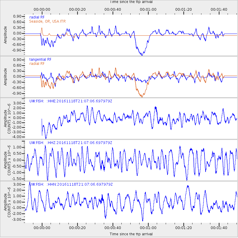
FISH Seaside, OR, USA - Earthquake Result Viewer
*The percent match for this event was below the threshold and hence no stack was calculated.
| Earthquake location: |
Kermadec Islands Region |
| Earthquake latitude/longitude: |
-28.1/-177.0 |
| Earthquake time(UTC): |
2016/11/18 (323) 20:54:47 GMT |
| Earthquake Depth: |
10 km |
| Earthquake Magnitude: |
5.5 MB |
| Earthquake Catalog/Contributor: |
NEIC PDE/NEIC COMCAT |
|
| Network: |
UW Pacific Northwest Regional Seismic Network |
| Station: |
FISH Seaside, OR, USA |
| Lat/Lon: |
45.93 N/123.56 W |
| Elevation: |
325 m |
|
| Distance: |
88.2 deg |
| Az: |
34.125 deg |
| Baz: |
225.228 deg |
| Ray Param: |
$rayparam |
*The percent match for this event was below the threshold and hence was not used in the summary stack. |
|
| Radial Match: |
32.874996 % |
| Radial Bump: |
400 |
| Transverse Match: |
45.287872 % |
| Transverse Bump: |
400 |
| SOD ConfigId: |
11737051 |
| Insert Time: |
2019-04-26 02:46:10.102 +0000 |
| GWidth: |
2.5 |
| Max Bumps: |
400 |
| Tol: |
0.001 |
|
Signal To Noise
| Channel | StoN | STA | LTA |
| UW:FISH: :HHZ:20161118T21:07:06.697979Z | 1.8884747 | 7.120223E-7 | 3.7703566E-7 |
| UW:FISH: :HHN:20161118T21:07:06.697979Z | 0.99438703 | 1.2591463E-6 | 1.2662538E-6 |
| UW:FISH: :HHE:20161118T21:07:06.697979Z | 0.9391786 | 1.2592275E-6 | 1.3407754E-6 |
| Arrivals |
| Ps | |
| PpPs | |
| PsPs/PpSs | |


