ORV Oroville Dam, CA - Earthquake Result Viewer
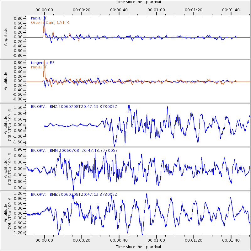
Earthquake location: Andreanof Islands, Aleutian Is.
Earthquake latitude/longitude: 51.2/-179.3
Earthquake time(UTC): 2006/07/08 (189) 20:40:00 GMT
Earthquake Depth: 22 km
Earthquake Magnitude: 6.2 MB, 6.4 MS, 6.6 MW, 6.6 MW
Earthquake Catalog/Contributor: WHDF/NEIC
Network: BK Berkeley Digital Seismograph Network
Station: ORV Oroville Dam, CA
Lat/Lon: 39.55 N/121.50 W
Elevation: 335 m
Distance: 41.2 deg
Az: 83.136 deg
Baz: 306.126 deg
Ray Param: 0.073893175
Estimated Moho Depth: 33.75 km
Estimated Crust Vp/Vs: 1.88
Assumed Crust Vp: 6.597 km/s
Estimated Crust Vs: 3.509 km/s
Estimated Crust Poisson's Ratio: 0.30
Radial Match: 96.11434 %
Radial Bump: 346
Transverse Match: 82.176155 %
Transverse Bump: 400
SOD ConfigId: 2665
Insert Time: 2010-03-05 19:45:47.641 +0000
GWidth: 2.5
Max Bumps: 400
Tol: 0.001

Signal To Noise

ChannelStoNSTALTA
BK:ORV: :BHN:20060708T20:47:13.373005Z2.5858411.1818161E-74.5703356E-8
BK:ORV: :BHE:20060708T20:47:13.373005Z3.0771292.4107345E-77.8343625E-8
BK:ORV: :BHZ:20060708T20:47:13.373005Z3.89509842.7088615E-76.9545386E-8
Arrivals
Ps4.8 SECOND
PpPs14 SECOND
PsPs/PpSs19 SECOND