You are here: Home > Network List > GS - US Geological Survey Networks Stations List
> Station KAN10 Keim Farm, Anthony, KS, USA > Earthquake Result Viewer
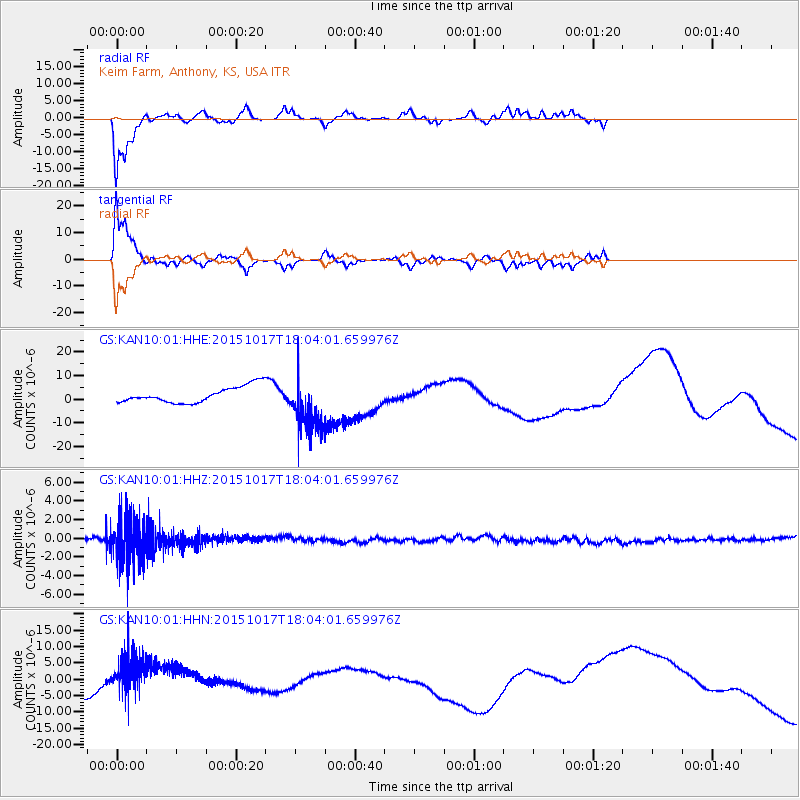
KAN10 Keim Farm, Anthony, KS, USA - Earthquake Result Viewer
*The percent match for this event was below the threshold and hence no stack was calculated.
| Earthquake location: |
West Chile Rise |
| Earthquake latitude/longitude: |
-42.6/-82.4 |
| Earthquake time(UTC): |
2015/10/17 (290) 17:52:20 GMT |
| Earthquake Depth: |
11 km |
| Earthquake Magnitude: |
5.6 MWW, 5.6 MWB, 5.6 MWC |
| Earthquake Catalog/Contributor: |
NEIC PDE/NEIC COMCAT |
|
| Network: |
GS US Geological Survey Networks |
| Station: |
KAN10 Keim Farm, Anthony, KS, USA |
| Lat/Lon: |
37.12 N/98.10 W |
| Elevation: |
417 m |
|
| Distance: |
80.6 deg |
| Az: |
347.381 deg |
| Baz: |
168.362 deg |
| Ray Param: |
$rayparam |
*The percent match for this event was below the threshold and hence was not used in the summary stack. |
|
| Radial Match: |
74.540016 % |
| Radial Bump: |
232 |
| Transverse Match: |
79.03238 % |
| Transverse Bump: |
309 |
| SOD ConfigId: |
1259291 |
| Insert Time: |
2015-10-31 18:09:09.106 +0000 |
| GWidth: |
2.5 |
| Max Bumps: |
400 |
| Tol: |
0.001 |
|
Signal To Noise
| Channel | StoN | STA | LTA |
| GS:KAN10:01:HHZ:20151017T18:04:01.659976Z | 15.914639 | 2.4454068E-6 | 1.536577E-7 |
| GS:KAN10:01:HHN:20151017T18:04:01.659976Z | 3.7037957 | 6.313265E-6 | 1.7045393E-6 |
| GS:KAN10:01:HHE:20151017T18:04:01.659976Z | 3.1622136 | 1.0669121E-5 | 3.373941E-6 |
| Arrivals |
| Ps | |
| PpPs | |
| PsPs/PpSs | |


