ORV Oroville Dam, CA - Earthquake Result Viewer
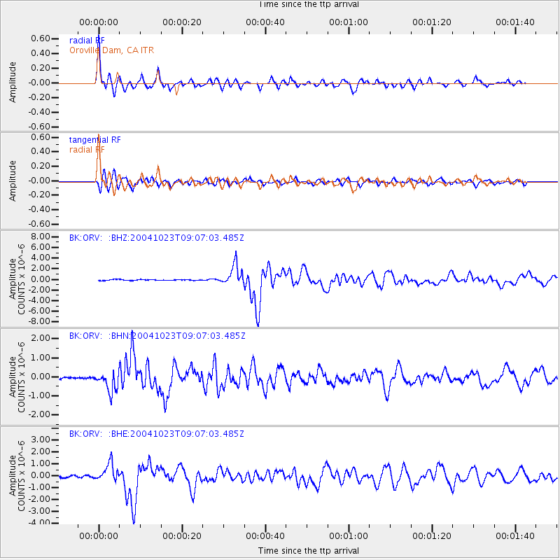
Earthquake location: Near West Coast Of Honshu, Japan
Earthquake latitude/longitude: 37.2/138.8
Earthquake time(UTC): 2004/10/23 (297) 08:56:00 GMT
Earthquake Depth: 16 km
Earthquake Magnitude: 6.4 MB, 6.3 MS, 6.6 MW, 6.4 MW
Earthquake Catalog/Contributor: WHDF/NEIC
Network: BK Berkeley Digital Seismograph Network
Station: ORV Oroville Dam, CA
Lat/Lon: 39.55 N/121.50 W
Elevation: 335 m
Distance: 73.9 deg
Az: 52.491 deg
Baz: 305.015 deg
Ray Param: 0.052706074
Estimated Moho Depth: 63.0 km
Estimated Crust Vp/Vs: 2.06
Assumed Crust Vp: 6.597 km/s
Estimated Crust Vs: 3.199 km/s
Estimated Crust Poisson's Ratio: 0.35
Radial Match: 93.998055 %
Radial Bump: 400
Transverse Match: 86.47504 %
Transverse Bump: 400
SOD ConfigId: 2459
Insert Time: 2010-03-05 19:46:38.718 +0000
GWidth: 2.5
Max Bumps: 400
Tol: 0.001

Signal To Noise

ChannelStoNSTALTA
BK:ORV: :BHN:20041023T09:07:03.485Z5.2010375.2704826E-71.0133523E-7
BK:ORV: :BHE:20041023T09:07:03.485Z6.57430937.6802746E-71.1682254E-7
BK:ORV: :BHZ:20041023T09:07:03.485Z23.0542661.9088413E-68.279775E-8
Arrivals
Ps10 SECOND
PpPs28 SECOND
PsPs/PpSs39 SECOND