ORV Oroville Dam, CA - Earthquake Result Viewer
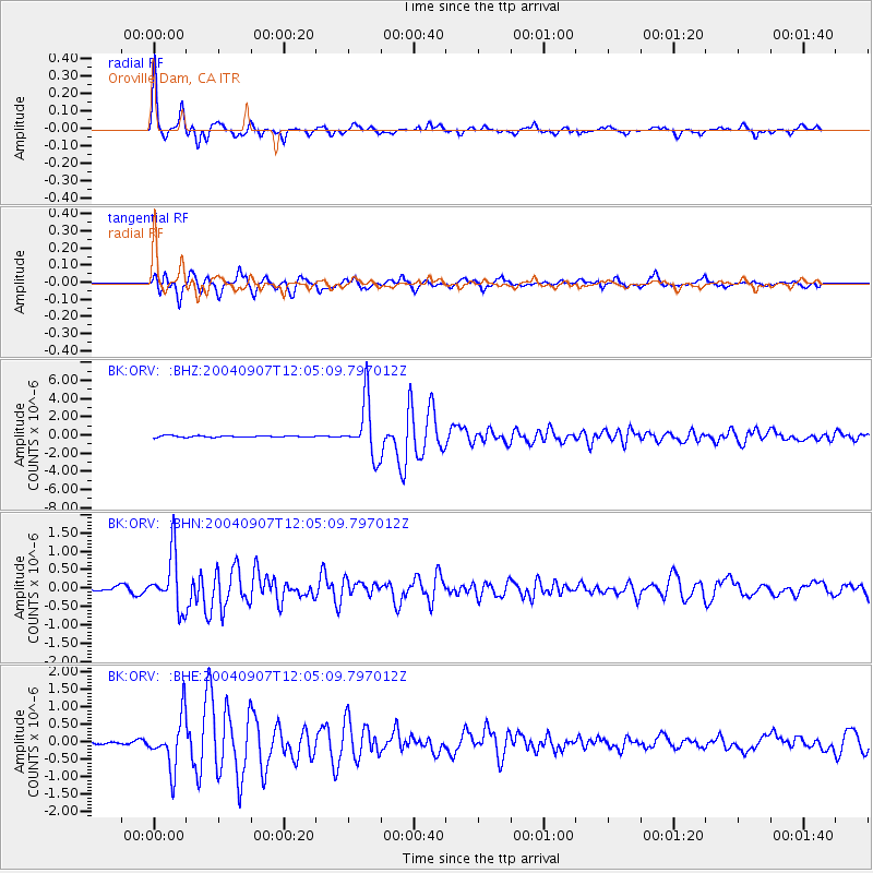
Earthquake location: Santiago Del Estero Prov., Arg.
Earthquake latitude/longitude: -28.6/-65.8
Earthquake time(UTC): 2004/09/07 (251) 11:53:06 GMT
Earthquake Depth: 22 km
Earthquake Magnitude: 6.1 MB, 6.1 MS, 6.4 MW, 6.2 MW
Earthquake Catalog/Contributor: WHDF/NEIC
Network: BK Berkeley Digital Seismograph Network
Station: ORV Oroville Dam, CA
Lat/Lon: 39.55 N/121.50 W
Elevation: 335 m
Distance: 85.3 deg
Az: 320.17 deg
Baz: 133.223 deg
Ray Param: 0.044835493
Estimated Moho Depth: 36.75 km
Estimated Crust Vp/Vs: 1.75
Assumed Crust Vp: 6.597 km/s
Estimated Crust Vs: 3.781 km/s
Estimated Crust Poisson's Ratio: 0.26
Radial Match: 95.1658 %
Radial Bump: 304
Transverse Match: 88.21233 %
Transverse Bump: 400
SOD ConfigId: 2459
Insert Time: 2010-03-05 19:46:48.364 +0000
GWidth: 2.5
Max Bumps: 400
Tol: 0.001

Signal To Noise

ChannelStoNSTALTA
BK:ORV: :BHN:20040907T12:05:09.797012Z6.5093437.313322E-71.1235115E-7
BK:ORV: :BHE:20040907T12:05:09.797012Z7.64014967.31608E-79.575833E-8
BK:ORV: :BHZ:20040907T12:05:09.797012Z36.285383.012436E-68.302065E-8
Arrivals
Ps4.3 SECOND
PpPs15 SECOND
PsPs/PpSs19 SECOND