You are here: Home > Network List > GS - US Geological Survey Networks Stations List
> Station KAN11 Stewart Ranch, Harper County, KS, USA > Earthquake Result Viewer
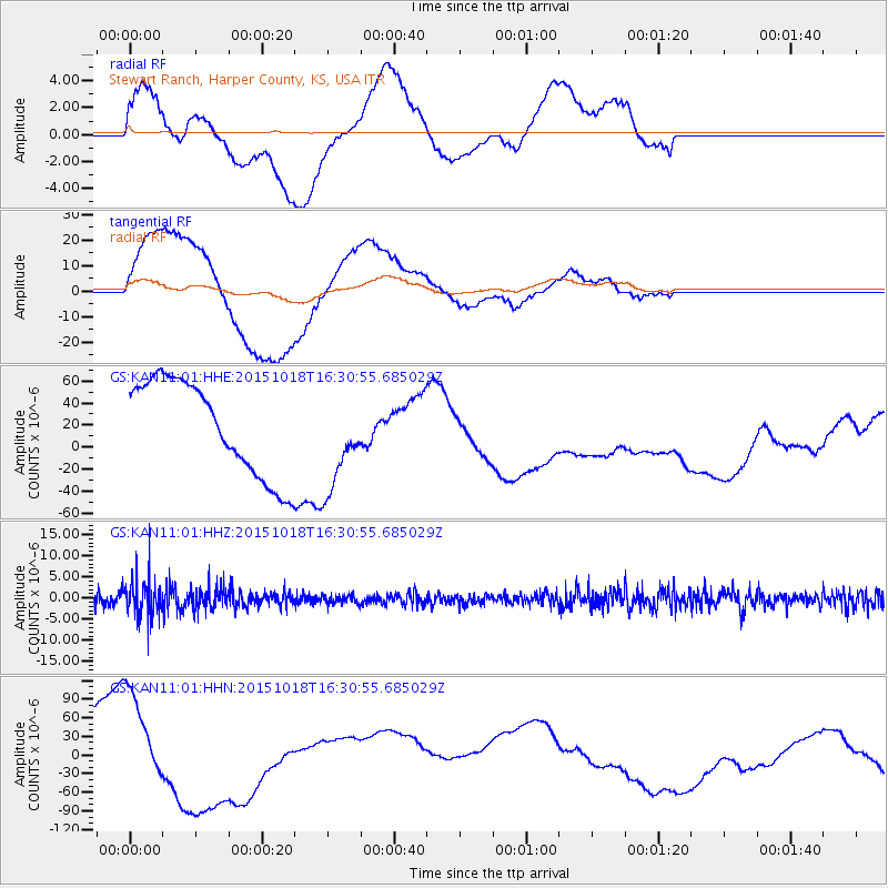
KAN11 Stewart Ranch, Harper County, KS, USA - Earthquake Result Viewer
*The percent match for this event was below the threshold and hence no stack was calculated.
| Earthquake location: |
Tonga Islands |
| Earthquake latitude/longitude: |
-16.3/-173.2 |
| Earthquake time(UTC): |
2015/10/18 (291) 16:18:35 GMT |
| Earthquake Depth: |
10 km |
| Earthquake Magnitude: |
5.9 MWB |
| Earthquake Catalog/Contributor: |
NEIC PDE/NEIC COMCAT |
|
| Network: |
GS US Geological Survey Networks |
| Station: |
KAN11 Stewart Ranch, Harper County, KS, USA |
| Lat/Lon: |
37.21 N/97.91 W |
| Elevation: |
410 m |
|
| Distance: |
88.4 deg |
| Az: |
50.577 deg |
| Baz: |
248.329 deg |
| Ray Param: |
$rayparam |
*The percent match for this event was below the threshold and hence was not used in the summary stack. |
|
| Radial Match: |
56.698006 % |
| Radial Bump: |
400 |
| Transverse Match: |
65.62082 % |
| Transverse Bump: |
400 |
| SOD ConfigId: |
1259291 |
| Insert Time: |
2015-11-01 16:38:39.055 +0000 |
| GWidth: |
2.5 |
| Max Bumps: |
400 |
| Tol: |
0.001 |
|
Signal To Noise
| Channel | StoN | STA | LTA |
| GS:KAN11:01:HHZ:20151018T16:30:55.685029Z | 2.8954468 | 4.5087727E-6 | 1.5571941E-6 |
| GS:KAN11:01:HHN:20151018T16:30:55.685029Z | 1.5569253 | 1.0126108E-4 | 6.503914E-5 |
| GS:KAN11:01:HHE:20151018T16:30:55.685029Z | 1.054056 | 4.4828572E-5 | 4.2529588E-5 |
| Arrivals |
| Ps | |
| PpPs | |
| PsPs/PpSs | |


