You are here: Home > Network List > GS - US Geological Survey Networks Stations List
> Station KAN13 Rinehart Farm, , CA, USA > Earthquake Result Viewer
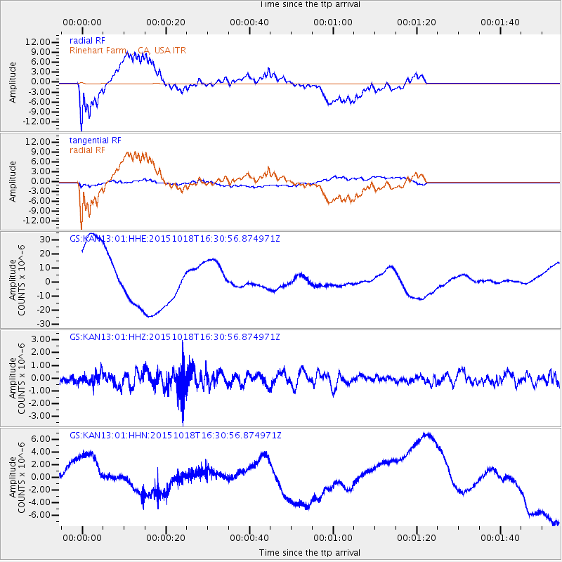
KAN13 Rinehart Farm, , CA, USA - Earthquake Result Viewer
*The percent match for this event was below the threshold and hence no stack was calculated.
| Earthquake location: |
Tonga Islands |
| Earthquake latitude/longitude: |
-16.3/-173.2 |
| Earthquake time(UTC): |
2015/10/18 (291) 16:18:35 GMT |
| Earthquake Depth: |
10 km |
| Earthquake Magnitude: |
5.9 MWB |
| Earthquake Catalog/Contributor: |
NEIC PDE/NEIC COMCAT |
|
| Network: |
GS US Geological Survey Networks |
| Station: |
KAN13 Rinehart Farm, , CA, USA |
| Lat/Lon: |
37.01 N/97.48 W |
| Elevation: |
340 m |
|
| Distance: |
88.7 deg |
| Az: |
50.884 deg |
| Baz: |
248.598 deg |
| Ray Param: |
$rayparam |
*The percent match for this event was below the threshold and hence was not used in the summary stack. |
|
| Radial Match: |
49.214016 % |
| Radial Bump: |
400 |
| Transverse Match: |
33.076283 % |
| Transverse Bump: |
400 |
| SOD ConfigId: |
1259291 |
| Insert Time: |
2015-11-01 16:38:46.709 +0000 |
| GWidth: |
2.5 |
| Max Bumps: |
400 |
| Tol: |
0.001 |
|
Signal To Noise
| Channel | StoN | STA | LTA |
| GS:KAN13:01:HHZ:20151018T16:30:56.874971Z | 1.3314649 | 4.2920647E-7 | 3.2235656E-7 |
| GS:KAN13:01:HHN:20151018T16:30:56.874971Z | 0.27911368 | 2.1994742E-6 | 7.880209E-6 |
| GS:KAN13:01:HHE:20151018T16:30:56.874971Z | 0.6439899 | 1.30490525E-5 | 2.0262822E-5 |
| Arrivals |
| Ps | |
| PpPs | |
| PsPs/PpSs | |


