You are here: Home > Network List > US - United States National Seismic Network Stations List
> Station AMTX Amarillo, Texas, USA > Earthquake Result Viewer
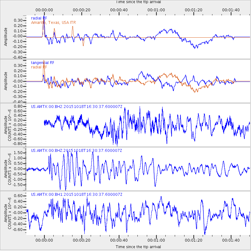
AMTX Amarillo, Texas, USA - Earthquake Result Viewer
*The percent match for this event was below the threshold and hence no stack was calculated.
| Earthquake location: |
Tonga Islands |
| Earthquake latitude/longitude: |
-16.3/-173.2 |
| Earthquake time(UTC): |
2015/10/18 (291) 16:18:35 GMT |
| Earthquake Depth: |
10 km |
| Earthquake Magnitude: |
5.9 MWB |
| Earthquake Catalog/Contributor: |
NEIC PDE/NEIC COMCAT |
|
| Network: |
US United States National Seismic Network |
| Station: |
AMTX Amarillo, Texas, USA |
| Lat/Lon: |
34.53 N/101.41 W |
| Elevation: |
1010 m |
|
| Distance: |
84.8 deg |
| Az: |
51.949 deg |
| Baz: |
246.371 deg |
| Ray Param: |
$rayparam |
*The percent match for this event was below the threshold and hence was not used in the summary stack. |
|
| Radial Match: |
63.741417 % |
| Radial Bump: |
400 |
| Transverse Match: |
55.326145 % |
| Transverse Bump: |
400 |
| SOD ConfigId: |
1259291 |
| Insert Time: |
2015-11-01 16:42:03.966 +0000 |
| GWidth: |
2.5 |
| Max Bumps: |
400 |
| Tol: |
0.001 |
|
Signal To Noise
| Channel | StoN | STA | LTA |
| US:AMTX:00:BHZ:20151018T16:30:37.600007Z | 4.9919715 | 5.0103506E-7 | 1.00368176E-7 |
| US:AMTX:00:BH1:20151018T16:30:37.600007Z | 1.0428708 | 2.4353523E-7 | 2.3352388E-7 |
| US:AMTX:00:BH2:20151018T16:30:37.600007Z | 2.7671673 | 4.3146056E-7 | 1.5592138E-7 |
| Arrivals |
| Ps | |
| PpPs | |
| PsPs/PpSs | |


