You are here: Home > Network List > CI - Caltech Regional Seismic Network Stations List
> Station MPP McPhearson Peak > Earthquake Result Viewer
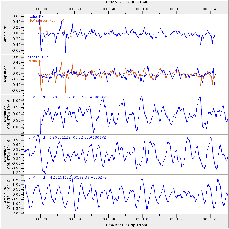
MPP McPhearson Peak - Earthquake Result Viewer
*The percent match for this event was below the threshold and hence no stack was calculated.
| Earthquake location: |
Off E. Coast Of N. Island, N.Z. |
| Earthquake latitude/longitude: |
-40.6/177.1 |
| Earthquake time(UTC): |
2016/11/22 (327) 00:19:42 GMT |
| Earthquake Depth: |
9.6 km |
| Earthquake Magnitude: |
5.9 MWW |
| Earthquake Catalog/Contributor: |
NEIC PDE/NEIC COMCAT |
|
| Network: |
CI Caltech Regional Seismic Network |
| Station: |
MPP McPhearson Peak |
| Lat/Lon: |
34.89 N/119.81 W |
| Elevation: |
1739 m |
|
| Distance: |
94.9 deg |
| Az: |
47.376 deg |
| Baz: |
222.972 deg |
| Ray Param: |
$rayparam |
*The percent match for this event was below the threshold and hence was not used in the summary stack. |
|
| Radial Match: |
68.147896 % |
| Radial Bump: |
400 |
| Transverse Match: |
61.651787 % |
| Transverse Bump: |
400 |
| SOD ConfigId: |
11737051 |
| Insert Time: |
2019-04-26 03:18:43.719 +0000 |
| GWidth: |
2.5 |
| Max Bumps: |
400 |
| Tol: |
0.001 |
|
Signal To Noise
| Channel | StoN | STA | LTA |
| CI:MPP: :HHZ:20161122T00:32:33.418027Z | 2.369421 | 8.2485326E-7 | 3.481244E-7 |
| CI:MPP: :HHN:20161122T00:32:33.418027Z | 1.0398903 | 6.472629E-7 | 6.224338E-7 |
| CI:MPP: :HHE:20161122T00:32:33.418027Z | 1.877288 | 7.0619694E-7 | 3.7617934E-7 |
| Arrivals |
| Ps | |
| PpPs | |
| PsPs/PpSs | |


