You are here: Home > Network List > TA - USArray Transportable Network (new EarthScope stations) Stations List
> Station A21K Barrow, AK, USA > Earthquake Result Viewer
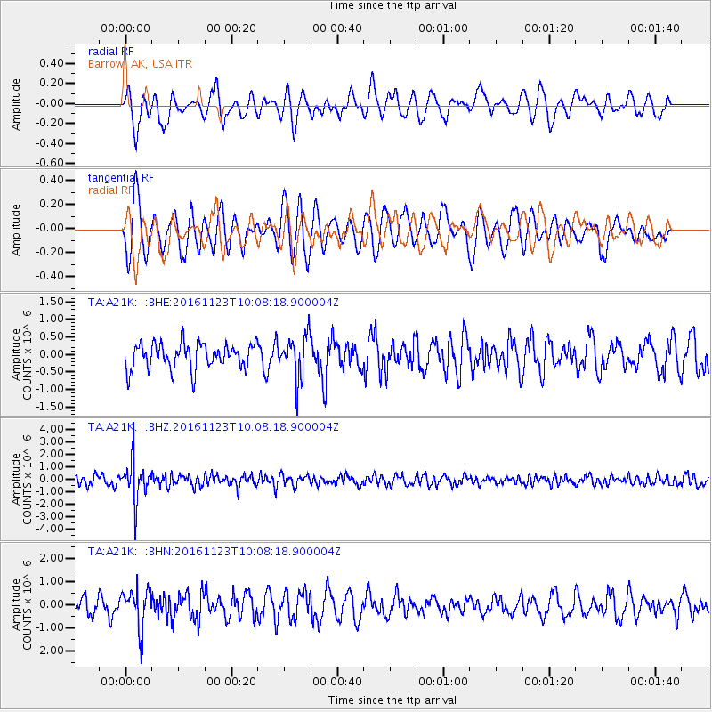
A21K Barrow, AK, USA - Earthquake Result Viewer
*The percent match for this event was below the threshold and hence no stack was calculated.
| Earthquake location: |
Bonin Islands, Japan Region |
| Earthquake latitude/longitude: |
27.2/140.0 |
| Earthquake time(UTC): |
2016/11/23 (328) 09:59:56 GMT |
| Earthquake Depth: |
477 km |
| Earthquake Magnitude: |
5.7 MB |
| Earthquake Catalog/Contributor: |
NEIC PDE/NEIC COMCAT |
|
| Network: |
TA USArray Transportable Network (new EarthScope stations) |
| Station: |
A21K Barrow, AK, USA |
| Lat/Lon: |
71.32 N/156.62 W |
| Elevation: |
577 m |
|
| Distance: |
56.0 deg |
| Az: |
20.314 deg |
| Baz: |
253.759 deg |
| Ray Param: |
$rayparam |
*The percent match for this event was below the threshold and hence was not used in the summary stack. |
|
| Radial Match: |
59.734947 % |
| Radial Bump: |
400 |
| Transverse Match: |
57.846333 % |
| Transverse Bump: |
400 |
| SOD ConfigId: |
11737051 |
| Insert Time: |
2019-04-26 03:29:14.884 +0000 |
| GWidth: |
2.5 |
| Max Bumps: |
400 |
| Tol: |
0.001 |
|
Signal To Noise
| Channel | StoN | STA | LTA |
| TA:A21K: :BHZ:20161123T10:08:18.900004Z | 4.9966516 | 1.5240635E-6 | 3.0501698E-7 |
| TA:A21K: :BHN:20161123T10:08:18.900004Z | 2.1434224 | 8.563051E-7 | 3.9950368E-7 |
| TA:A21K: :BHE:20161123T10:08:18.900004Z | 1.7171911 | 6.209225E-7 | 3.6159196E-7 |
| Arrivals |
| Ps | |
| PpPs | |
| PsPs/PpSs | |


