You are here: Home > Network List > TA - USArray Transportable Network (new EarthScope stations) Stations List
> Station D23K Nanushuk River, AK USA > Earthquake Result Viewer
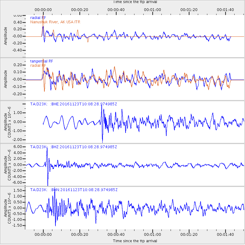
D23K Nanushuk River, AK USA - Earthquake Result Viewer
*The percent match for this event was below the threshold and hence no stack was calculated.
| Earthquake location: |
Bonin Islands, Japan Region |
| Earthquake latitude/longitude: |
27.2/140.0 |
| Earthquake time(UTC): |
2016/11/23 (328) 09:59:56 GMT |
| Earthquake Depth: |
477 km |
| Earthquake Magnitude: |
5.7 MB |
| Earthquake Catalog/Contributor: |
NEIC PDE/NEIC COMCAT |
|
| Network: |
TA USArray Transportable Network (new EarthScope stations) |
| Station: |
D23K Nanushuk River, AK USA |
| Lat/Lon: |
68.97 N/150.68 W |
| Elevation: |
406 m |
|
| Distance: |
57.5 deg |
| Az: |
23.601 deg |
| Baz: |
261.142 deg |
| Ray Param: |
$rayparam |
*The percent match for this event was below the threshold and hence was not used in the summary stack. |
|
| Radial Match: |
54.161995 % |
| Radial Bump: |
400 |
| Transverse Match: |
62.587143 % |
| Transverse Bump: |
400 |
| SOD ConfigId: |
11737051 |
| Insert Time: |
2019-04-26 03:29:21.770 +0000 |
| GWidth: |
2.5 |
| Max Bumps: |
400 |
| Tol: |
0.001 |
|
Signal To Noise
| Channel | StoN | STA | LTA |
| TA:D23K: :BHZ:20161123T10:08:28.974985Z | 7.6016793 | 2.1777337E-6 | 2.864806E-7 |
| TA:D23K: :BHN:20161123T10:08:28.974985Z | 0.9589144 | 3.1868757E-7 | 3.3234204E-7 |
| TA:D23K: :BHE:20161123T10:08:28.974985Z | 2.0026245 | 8.0254057E-7 | 4.0074443E-7 |
| Arrivals |
| Ps | |
| PpPs | |
| PsPs/PpSs | |


