You are here: Home > Network List > TA - USArray Transportable Network (new EarthScope stations) Stations List
> Station MDND Maddock, ND, USA > Earthquake Result Viewer
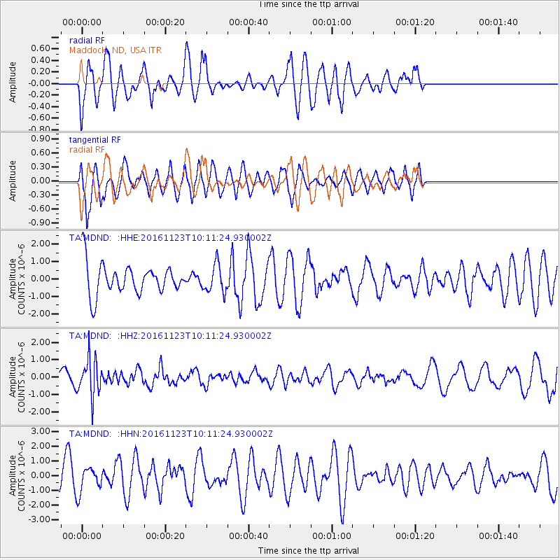
MDND Maddock, ND, USA - Earthquake Result Viewer
*The percent match for this event was below the threshold and hence no stack was calculated.
| Earthquake location: |
Bonin Islands, Japan Region |
| Earthquake latitude/longitude: |
27.2/140.0 |
| Earthquake time(UTC): |
2016/11/23 (328) 09:59:56 GMT |
| Earthquake Depth: |
477 km |
| Earthquake Magnitude: |
5.7 MB |
| Earthquake Catalog/Contributor: |
NEIC PDE/NEIC COMCAT |
|
| Network: |
TA USArray Transportable Network (new EarthScope stations) |
| Station: |
MDND Maddock, ND, USA |
| Lat/Lon: |
47.85 N/99.60 W |
| Elevation: |
479 m |
|
| Distance: |
88.2 deg |
| Az: |
35.552 deg |
| Baz: |
309.724 deg |
| Ray Param: |
$rayparam |
*The percent match for this event was below the threshold and hence was not used in the summary stack. |
|
| Radial Match: |
53.983616 % |
| Radial Bump: |
400 |
| Transverse Match: |
67.67366 % |
| Transverse Bump: |
400 |
| SOD ConfigId: |
11737051 |
| Insert Time: |
2019-04-26 03:30:00.380 +0000 |
| GWidth: |
2.5 |
| Max Bumps: |
400 |
| Tol: |
0.001 |
|
Signal To Noise
| Channel | StoN | STA | LTA |
| TA:MDND: :HHZ:20161123T10:11:24.930002Z | 2.0848472 | 1.056348E-6 | 5.066788E-7 |
| TA:MDND: :HHN:20161123T10:11:24.930002Z | 0.8005918 | 8.0309394E-7 | 1.0031254E-6 |
| TA:MDND: :HHE:20161123T10:11:24.930002Z | 0.93646973 | 8.219091E-7 | 8.7766756E-7 |
| Arrivals |
| Ps | |
| PpPs | |
| PsPs/PpSs | |


