You are here: Home > Network List > UW - Pacific Northwest Regional Seismic Network Stations List
> Station FISH Seaside, OR, USA > Earthquake Result Viewer
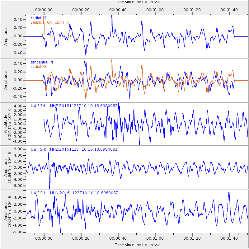
FISH Seaside, OR, USA - Earthquake Result Viewer
*The percent match for this event was below the threshold and hence no stack was calculated.
| Earthquake location: |
Bonin Islands, Japan Region |
| Earthquake latitude/longitude: |
27.2/140.0 |
| Earthquake time(UTC): |
2016/11/23 (328) 09:59:56 GMT |
| Earthquake Depth: |
477 km |
| Earthquake Magnitude: |
5.7 MB |
| Earthquake Catalog/Contributor: |
NEIC PDE/NEIC COMCAT |
|
| Network: |
UW Pacific Northwest Regional Seismic Network |
| Station: |
FISH Seaside, OR, USA |
| Lat/Lon: |
45.93 N/123.56 W |
| Elevation: |
325 m |
|
| Distance: |
75.2 deg |
| Az: |
45.841 deg |
| Baz: |
293.671 deg |
| Ray Param: |
$rayparam |
*The percent match for this event was below the threshold and hence was not used in the summary stack. |
|
| Radial Match: |
48.773403 % |
| Radial Bump: |
400 |
| Transverse Match: |
49.12534 % |
| Transverse Bump: |
400 |
| SOD ConfigId: |
11737051 |
| Insert Time: |
2019-04-26 03:31:29.706 +0000 |
| GWidth: |
2.5 |
| Max Bumps: |
400 |
| Tol: |
0.001 |
|
Signal To Noise
| Channel | StoN | STA | LTA |
| UW:FISH: :HHZ:20161123T10:10:18.698008Z | 2.0304067 | 2.1980472E-6 | 1.0825651E-6 |
| UW:FISH: :HHN:20161123T10:10:18.698008Z | 0.96407855 | 1.6018331E-6 | 1.6615171E-6 |
| UW:FISH: :HHE:20161123T10:10:18.698008Z | 0.88949144 | 1.5255763E-6 | 1.7151107E-6 |
| Arrivals |
| Ps | |
| PpPs | |
| PsPs/PpSs | |


