You are here: Home > Network List > UW - Pacific Northwest Regional Seismic Network Stations List
> Station LEBA Lebam, WA, USA > Earthquake Result Viewer
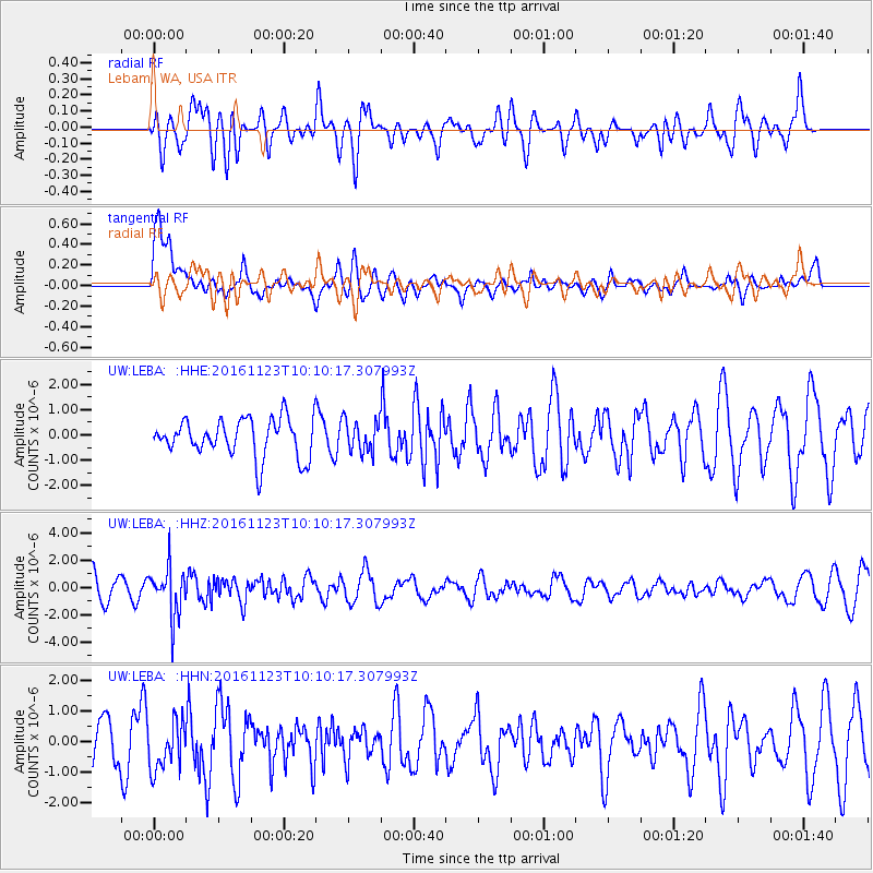
LEBA Lebam, WA, USA - Earthquake Result Viewer
*The percent match for this event was below the threshold and hence no stack was calculated.
| Earthquake location: |
Bonin Islands, Japan Region |
| Earthquake latitude/longitude: |
27.2/140.0 |
| Earthquake time(UTC): |
2016/11/23 (328) 09:59:56 GMT |
| Earthquake Depth: |
477 km |
| Earthquake Magnitude: |
5.7 MB |
| Earthquake Catalog/Contributor: |
NEIC PDE/NEIC COMCAT |
|
| Network: |
UW Pacific Northwest Regional Seismic Network |
| Station: |
LEBA Lebam, WA, USA |
| Lat/Lon: |
46.55 N/123.56 W |
| Elevation: |
73 m |
|
| Distance: |
74.9 deg |
| Az: |
45.258 deg |
| Baz: |
293.518 deg |
| Ray Param: |
$rayparam |
*The percent match for this event was below the threshold and hence was not used in the summary stack. |
|
| Radial Match: |
57.767242 % |
| Radial Bump: |
400 |
| Transverse Match: |
62.210743 % |
| Transverse Bump: |
400 |
| SOD ConfigId: |
11737051 |
| Insert Time: |
2019-04-26 03:31:35.252 +0000 |
| GWidth: |
2.5 |
| Max Bumps: |
400 |
| Tol: |
0.001 |
|
Signal To Noise
| Channel | StoN | STA | LTA |
| UW:LEBA: :HHZ:20161123T10:10:17.307993Z | 1.7783359 | 1.8023926E-6 | 1.0135276E-6 |
| UW:LEBA: :HHN:20161123T10:10:17.307993Z | 0.89859176 | 7.8203686E-7 | 8.702916E-7 |
| UW:LEBA: :HHE:20161123T10:10:17.307993Z | 0.8252235 | 6.2220477E-7 | 7.5398333E-7 |
| Arrivals |
| Ps | |
| PpPs | |
| PsPs/PpSs | |


