WDC Whiskeytown, CA - Earthquake Result Viewer
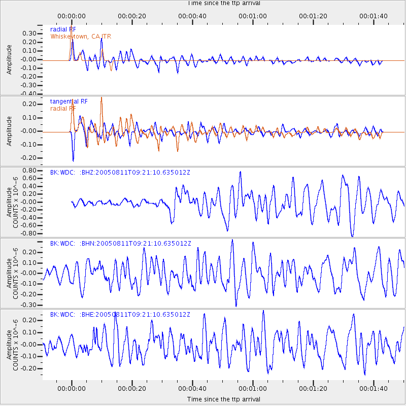
Earthquake location: Southeast Of Loyalty Islands
Earthquake latitude/longitude: -22.7/169.5
Earthquake time(UTC): 2005/08/11 (223) 09:08:46 GMT
Earthquake Depth: 10 km
Earthquake Magnitude: 5.7 MB, 6.0 MS, 6.2 MW, 6.2 MW
Earthquake Catalog/Contributor: WHDF/NEIC
Network: BK Berkeley Digital Seismograph Network
Station: WDC Whiskeytown, CA
Lat/Lon: 40.58 N/122.54 W
Elevation: 268 m
Distance: 89.1 deg
Az: 44.913 deg
Baz: 238.888 deg
Ray Param: 0.042096183
Estimated Moho Depth: 23.5 km
Estimated Crust Vp/Vs: 1.84
Assumed Crust Vp: 6.566 km/s
Estimated Crust Vs: 3.569 km/s
Estimated Crust Poisson's Ratio: 0.29
Radial Match: 86.81519 %
Radial Bump: 400
Transverse Match: 82.60819 %
Transverse Bump: 400
SOD ConfigId: 2475
Insert Time: 2010-03-05 19:56:36.710 +0000
GWidth: 2.5
Max Bumps: 400
Tol: 0.001

Signal To Noise

ChannelStoNSTALTA
BK:WDC: :BHN:20050811T09:21:10.635012Z3.3207221.1490915E-73.4603662E-8
BK:WDC: :BHE:20050811T09:21:10.635012Z0.86550515.3437116E-86.174096E-8
BK:WDC: :BHZ:20050811T09:21:10.635012Z4.5401132.5658363E-75.6514807E-8
Arrivals
Ps3.1 SECOND
PpPs10.0 SECOND
PsPs/PpSs13 SECOND