You are here: Home > Network List > CI - Caltech Regional Seismic Network Stations List
> Station SHO Shoshone, CA, USA > Earthquake Result Viewer
SHO Shoshone, CA, USA - Earthquake Result Viewer

| Earthquake location: |
Off Coast Of Central America |
| Earthquake latitude/longitude: |
12.0/-88.8 |
| Earthquake time(UTC): |
2016/11/24 (329) 18:43:48 GMT |
| Earthquake Depth: |
10 km |
| Earthquake Magnitude: |
7.0 MWW, 6.7 MWB, 7.2 MI |
| Earthquake Catalog/Contributor: |
NEIC PDE/NEIC COMCAT |
|
| Network: |
CI Caltech Regional Seismic Network |
| Station: |
SHO Shoshone, CA, USA |
| Lat/Lon: |
35.90 N/116.28 W |
| Elevation: |
451 m |
|
| Distance: |
34.4 deg |
| Az: |
318.501 deg |
| Baz: |
127.002 deg |
| Ray Param: |
0.07777179 |
| Estimated Moho Depth: |
15.75 km |
| Estimated Crust Vp/Vs: |
1.93 |
| Assumed Crust Vp: |
6.276 km/s |
| Estimated Crust Vs: |
3.243 km/s |
| Estimated Crust Poisson's Ratio: |
0.32 |
|
| Radial Match: |
90.01947 % |
| Radial Bump: |
400 |
| Transverse Match: |
73.63542 % |
| Transverse Bump: |
400 |
| SOD ConfigId: |
11737051 |
| Insert Time: |
2019-04-26 03:47:38.720 +0000 |
| GWidth: |
2.5 |
| Max Bumps: |
400 |
| Tol: |
0.001 |
|
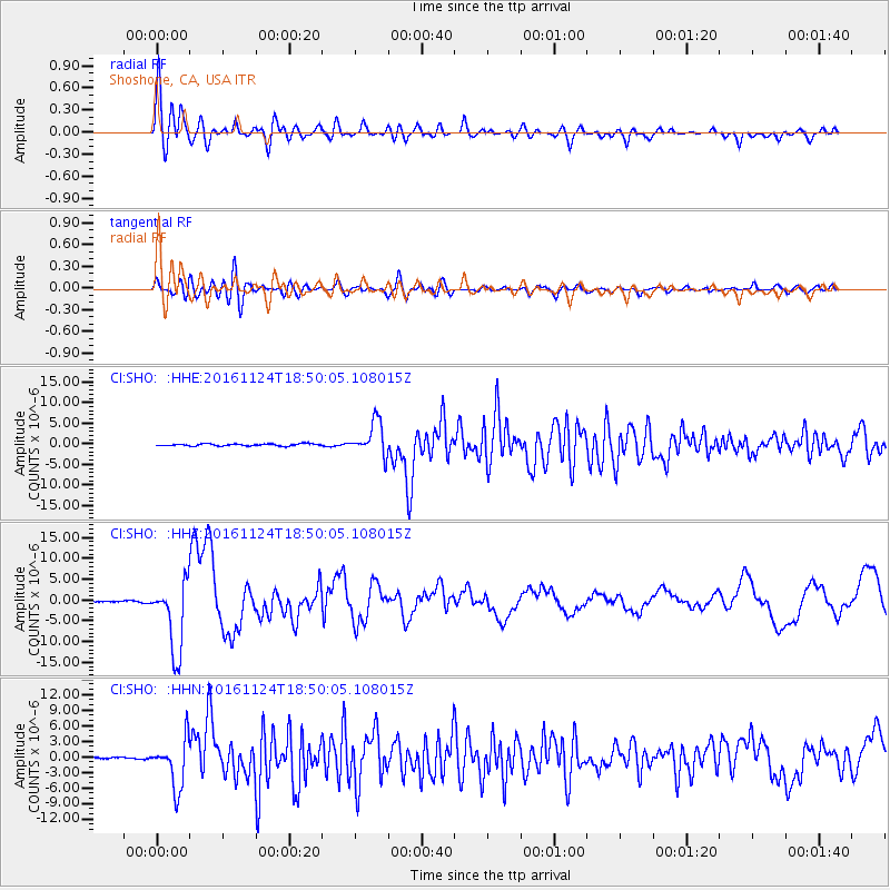
Signal To Noise
| Channel | StoN | STA | LTA |
| CI:SHO: :HHZ:20161124T18:50:05.108015Z | 51.502914 | 8.575864E-6 | 1.6651221E-7 |
| CI:SHO: :HHN:20161124T18:50:05.108015Z | 17.456999 | 4.6833497E-6 | 2.682792E-7 |
| CI:SHO: :HHE:20161124T18:50:05.108015Z | 15.403163 | 4.056315E-6 | 2.63343E-7 |
| Arrivals |
| Ps | 2.5 SECOND |
| PpPs | 6.9 SECOND |
| PsPs/PpSs | 9.4 SECOND |


