You are here: Home > Network List > NE - New England Seismic Network Stations List
> Station EMMW Machias, ME, USA > Earthquake Result Viewer
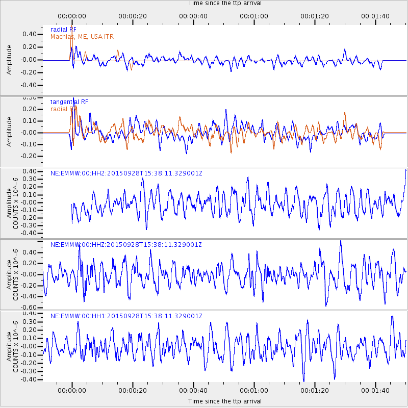
EMMW Machias, ME, USA - Earthquake Result Viewer
*The percent match for this event was below the threshold and hence no stack was calculated.
| Earthquake location: |
Jujuy Province, Argentina |
| Earthquake latitude/longitude: |
-23.8/-66.6 |
| Earthquake time(UTC): |
2015/09/28 (271) 15:28:05 GMT |
| Earthquake Depth: |
219 km |
| Earthquake Magnitude: |
5.9 MWW, 6.0 MWB, 6.0 MWC |
| Earthquake Catalog/Contributor: |
NEIC PDE/NEIC COMCAT |
|
| Network: |
NE New England Seismic Network |
| Station: |
EMMW Machias, ME, USA |
| Lat/Lon: |
44.71 N/67.46 W |
| Elevation: |
35 m |
|
| Distance: |
68.2 deg |
| Az: |
359.33 deg |
| Baz: |
179.139 deg |
| Ray Param: |
$rayparam |
*The percent match for this event was below the threshold and hence was not used in the summary stack. |
|
| Radial Match: |
47.862167 % |
| Radial Bump: |
400 |
| Transverse Match: |
50.757065 % |
| Transverse Bump: |
400 |
| SOD ConfigId: |
1259291 |
| Insert Time: |
2015-11-02 23:20:18.148 +0000 |
| GWidth: |
2.5 |
| Max Bumps: |
400 |
| Tol: |
0.001 |
|
Signal To Noise
| Channel | StoN | STA | LTA |
| NE:EMMW:00:HHZ:20150928T15:38:11.329001Z | 1.065823 | 2.3818816E-7 | 2.2347818E-7 |
| NE:EMMW:00:HH1:20150928T15:38:11.329001Z | 0.7202715 | 1.243563E-7 | 1.7265198E-7 |
| NE:EMMW:00:HH2:20150928T15:38:11.329001Z | 0.9578256 | 1.16979514E-7 | 1.2213027E-7 |
| Arrivals |
| Ps | |
| PpPs | |
| PsPs/PpSs | |


