You are here: Home > Network List > TJ - Tajikistan National Seismic Network Stations List
> Station GARM Garm, Tajikistan > Earthquake Result Viewer
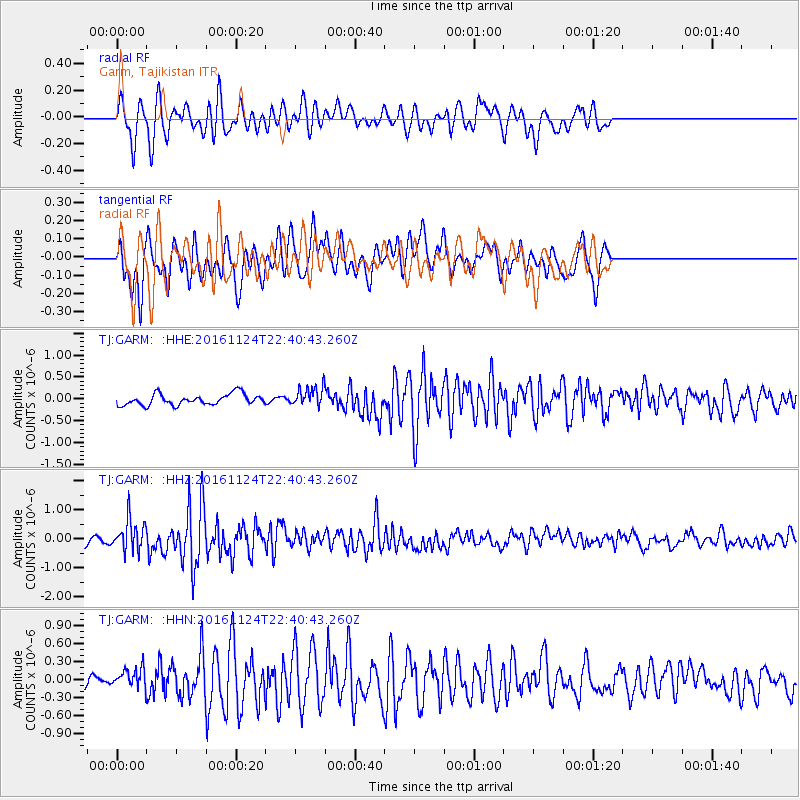
GARM Garm, Tajikistan - Earthquake Result Viewer
*The percent match for this event was below the threshold and hence no stack was calculated.
| Earthquake location: |
Komandorskiye Ostrova Region |
| Earthquake latitude/longitude: |
55.2/164.6 |
| Earthquake time(UTC): |
2016/11/24 (329) 22:31:01 GMT |
| Earthquake Depth: |
38 km |
| Earthquake Magnitude: |
5.5 MB |
| Earthquake Catalog/Contributor: |
NEIC PDE/NEIC COMCAT |
|
| Network: |
TJ Tajikistan National Seismic Network |
| Station: |
GARM Garm, Tajikistan |
| Lat/Lon: |
39.00 N/70.32 E |
| Elevation: |
1305 m |
|
| Distance: |
61.3 deg |
| Az: |
297.621 deg |
| Baz: |
40.653 deg |
| Ray Param: |
$rayparam |
*The percent match for this event was below the threshold and hence was not used in the summary stack. |
|
| Radial Match: |
72.727776 % |
| Radial Bump: |
400 |
| Transverse Match: |
73.37301 % |
| Transverse Bump: |
400 |
| SOD ConfigId: |
11737051 |
| Insert Time: |
2019-04-26 04:05:11.545 +0000 |
| GWidth: |
2.5 |
| Max Bumps: |
400 |
| Tol: |
0.001 |
|
Signal To Noise
| Channel | StoN | STA | LTA |
| TJ:GARM: :HHZ:20161124T22:40:43.260Z | 3.0426452 | 5.429543E-7 | 1.784481E-7 |
| TJ:GARM: :HHN:20161124T22:40:43.260Z | 1.6715869 | 1.8061063E-7 | 1.0804741E-7 |
| TJ:GARM: :HHE:20161124T22:40:43.260Z | 1.3816935 | 1.7537485E-7 | 1.2692746E-7 |
| Arrivals |
| Ps | |
| PpPs | |
| PsPs/PpSs | |


