You are here: Home > Network List > US - United States National Seismic Network Stations List
> Station AMTX Amarillo, Texas, USA > Earthquake Result Viewer
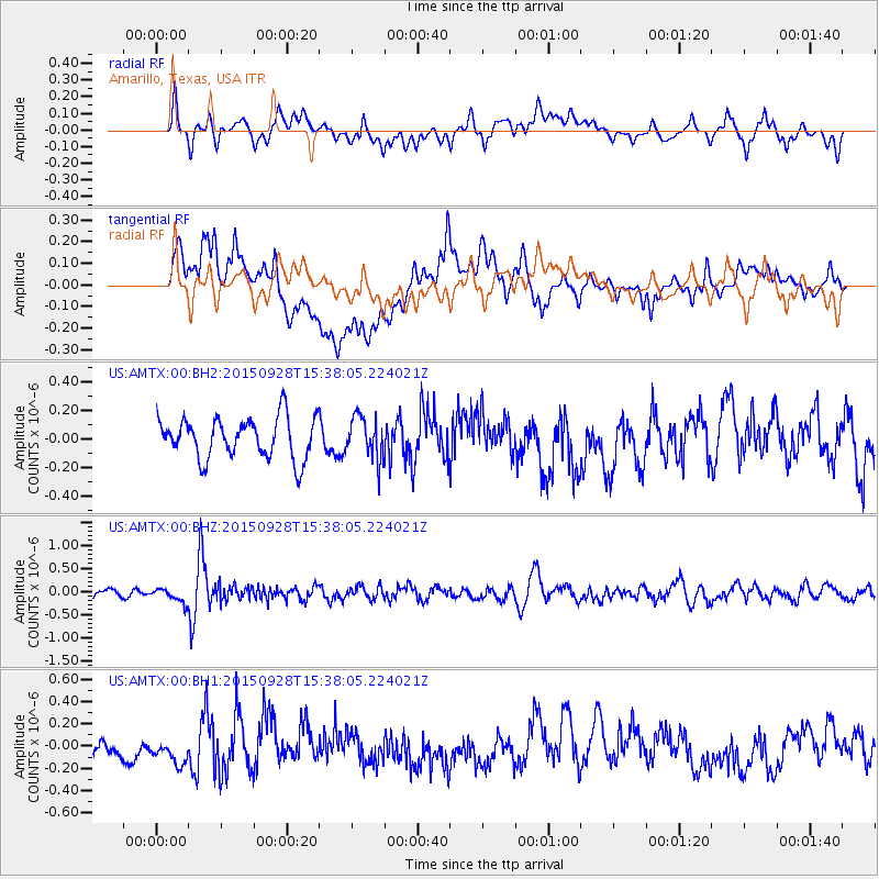
AMTX Amarillo, Texas, USA - Earthquake Result Viewer
*The percent match for this event was below the threshold and hence no stack was calculated.
| Earthquake location: |
Jujuy Province, Argentina |
| Earthquake latitude/longitude: |
-23.8/-66.6 |
| Earthquake time(UTC): |
2015/09/28 (271) 15:28:05 GMT |
| Earthquake Depth: |
219 km |
| Earthquake Magnitude: |
5.9 MWW, 6.0 MWB, 6.0 MWC |
| Earthquake Catalog/Contributor: |
NEIC PDE/NEIC COMCAT |
|
| Network: |
US United States National Seismic Network |
| Station: |
AMTX Amarillo, Texas, USA |
| Lat/Lon: |
34.53 N/101.41 W |
| Elevation: |
1010 m |
|
| Distance: |
66.8 deg |
| Az: |
329.132 deg |
| Baz: |
145.303 deg |
| Ray Param: |
$rayparam |
*The percent match for this event was below the threshold and hence was not used in the summary stack. |
|
| Radial Match: |
46.603035 % |
| Radial Bump: |
400 |
| Transverse Match: |
60.05205 % |
| Transverse Bump: |
400 |
| SOD ConfigId: |
1259291 |
| Insert Time: |
2015-11-02 23:21:52.692 +0000 |
| GWidth: |
2.5 |
| Max Bumps: |
400 |
| Tol: |
0.001 |
|
Signal To Noise
| Channel | StoN | STA | LTA |
| US:AMTX:00:BHZ:20150928T15:38:05.224021Z | 1.7066536 | 1.577644E-7 | 9.2440786E-8 |
| US:AMTX:00:BH1:20150928T15:38:05.224021Z | 1.379086 | 1.4606455E-7 | 1.05914026E-7 |
| US:AMTX:00:BH2:20150928T15:38:05.224021Z | 0.9054599 | 1.2920204E-7 | 1.4269217E-7 |
| Arrivals |
| Ps | |
| PpPs | |
| PsPs/PpSs | |


