You are here: Home > Network List > TA - USArray Transportable Network (new EarthScope stations) Stations List
> Station R11A Troy Canyon, Currant, NV, USA > Earthquake Result Viewer
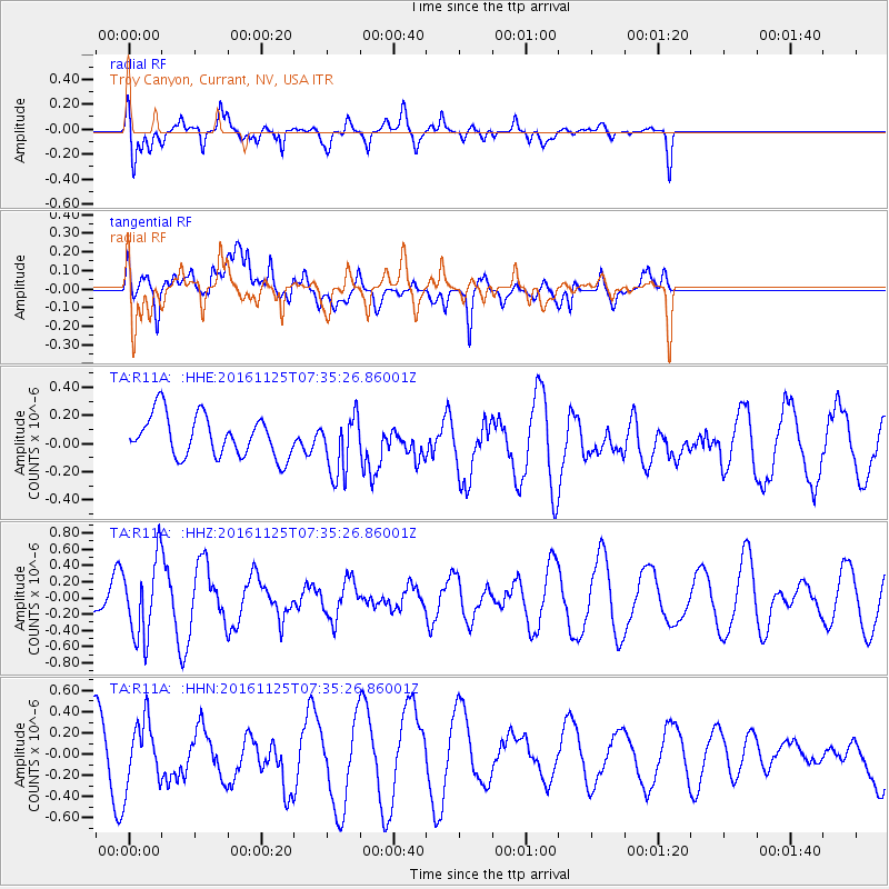
R11A Troy Canyon, Currant, NV, USA - Earthquake Result Viewer
*The percent match for this event was below the threshold and hence no stack was calculated.
| Earthquake location: |
Near East Coast Of Kamchatka |
| Earthquake latitude/longitude: |
54.4/160.6 |
| Earthquake time(UTC): |
2016/11/25 (330) 07:26:23 GMT |
| Earthquake Depth: |
84 km |
| Earthquake Magnitude: |
5.5 MB |
| Earthquake Catalog/Contributor: |
NEIC PDE/NEIC COMCAT |
|
| Network: |
TA USArray Transportable Network (new EarthScope stations) |
| Station: |
R11A Troy Canyon, Currant, NV, USA |
| Lat/Lon: |
38.35 N/115.59 W |
| Elevation: |
1756 m |
|
| Distance: |
56.6 deg |
| Az: |
69.477 deg |
| Baz: |
315.903 deg |
| Ray Param: |
$rayparam |
*The percent match for this event was below the threshold and hence was not used in the summary stack. |
|
| Radial Match: |
59.689644 % |
| Radial Bump: |
363 |
| Transverse Match: |
46.650936 % |
| Transverse Bump: |
400 |
| SOD ConfigId: |
11737051 |
| Insert Time: |
2019-04-26 04:14:55.516 +0000 |
| GWidth: |
2.5 |
| Max Bumps: |
400 |
| Tol: |
0.001 |
|
Signal To Noise
| Channel | StoN | STA | LTA |
| TA:R11A: :HHZ:20161125T07:35:26.86001Z | 1.8524497 | 4.8122934E-7 | 2.5977997E-7 |
| TA:R11A: :HHN:20161125T07:35:26.86001Z | 1.0115293 | 2.9488405E-7 | 2.9152298E-7 |
| TA:R11A: :HHE:20161125T07:35:26.86001Z | 1.4411094 | 2.1067537E-7 | 1.461897E-7 |
| Arrivals |
| Ps | |
| PpPs | |
| PsPs/PpSs | |


