You are here: Home > Network List > TA - USArray Transportable Network (new EarthScope stations) Stations List
> Station R31K City Hall, Gustavus, AK, USA > Earthquake Result Viewer
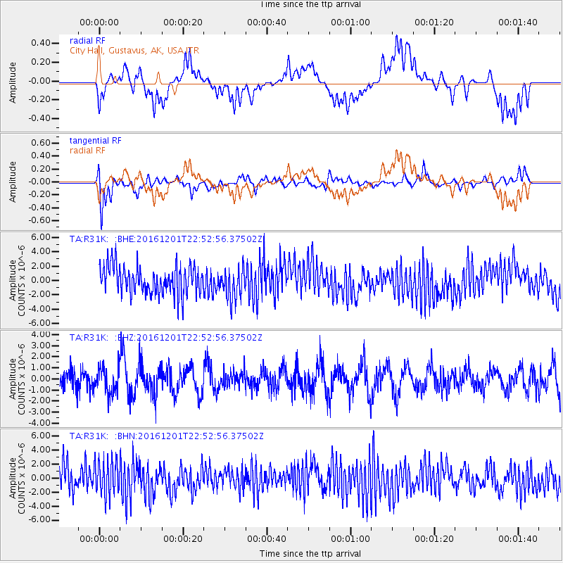
R31K City Hall, Gustavus, AK, USA - Earthquake Result Viewer
*The percent match for this event was below the threshold and hence no stack was calculated.
| Earthquake location: |
Southern Peru |
| Earthquake latitude/longitude: |
-15.3/-70.8 |
| Earthquake time(UTC): |
2016/12/01 (336) 22:40:26 GMT |
| Earthquake Depth: |
10 km |
| Earthquake Magnitude: |
6.3 Mww |
| Earthquake Catalog/Contributor: |
NEIC PDE/us |
|
| Network: |
TA USArray Transportable Network (new EarthScope stations) |
| Station: |
R31K City Hall, Gustavus, AK, USA |
| Lat/Lon: |
58.41 N/135.74 W |
| Elevation: |
15 m |
|
| Distance: |
90.5 deg |
| Az: |
331.529 deg |
| Baz: |
119.08 deg |
| Ray Param: |
$rayparam |
*The percent match for this event was below the threshold and hence was not used in the summary stack. |
|
| Radial Match: |
33.792805 % |
| Radial Bump: |
400 |
| Transverse Match: |
64.05481 % |
| Transverse Bump: |
400 |
| SOD ConfigId: |
11737051 |
| Insert Time: |
2019-04-26 04:49:55.267 +0000 |
| GWidth: |
2.5 |
| Max Bumps: |
400 |
| Tol: |
0.001 |
|
Signal To Noise
| Channel | StoN | STA | LTA |
| TA:R31K: :BHZ:20161201T22:52:56.37502Z | 1.0332984 | 1.1583729E-6 | 1.121044E-6 |
| TA:R31K: :BHN:20161201T22:52:56.37502Z | 1.2556927 | 2.4285869E-6 | 1.9340614E-6 |
| TA:R31K: :BHE:20161201T22:52:56.37502Z | 1.1475623 | 2.219649E-6 | 1.9342297E-6 |
| Arrivals |
| Ps | |
| PpPs | |
| PsPs/PpSs | |


