You are here: Home > Network List > TA - USArray Transportable Network (new EarthScope stations) Stations List
> Station T25A Trinidad, CO, USA > Earthquake Result Viewer
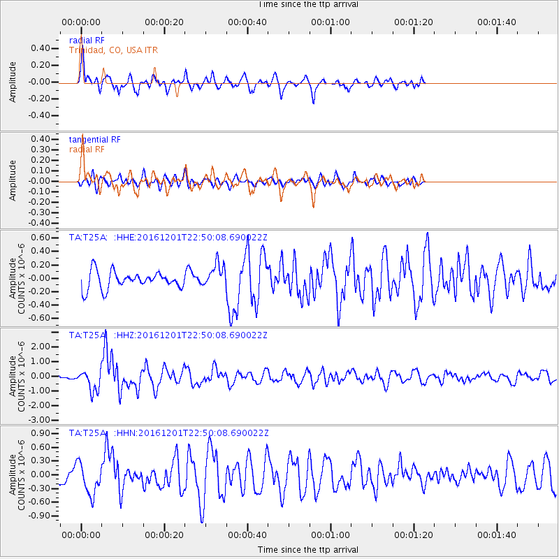
T25A Trinidad, CO, USA - Earthquake Result Viewer
*The percent match for this event was below the threshold and hence no stack was calculated.
| Earthquake location: |
Southern Peru |
| Earthquake latitude/longitude: |
-15.3/-70.8 |
| Earthquake time(UTC): |
2016/12/01 (336) 22:40:26 GMT |
| Earthquake Depth: |
10 km |
| Earthquake Magnitude: |
6.3 Mww |
| Earthquake Catalog/Contributor: |
NEIC PDE/us |
|
| Network: |
TA USArray Transportable Network (new EarthScope stations) |
| Station: |
T25A Trinidad, CO, USA |
| Lat/Lon: |
37.14 N/104.41 W |
| Elevation: |
2017 m |
|
| Distance: |
61.0 deg |
| Az: |
329.645 deg |
| Baz: |
142.396 deg |
| Ray Param: |
$rayparam |
*The percent match for this event was below the threshold and hence was not used in the summary stack. |
|
| Radial Match: |
70.2905 % |
| Radial Bump: |
353 |
| Transverse Match: |
51.51855 % |
| Transverse Bump: |
400 |
| SOD ConfigId: |
11737051 |
| Insert Time: |
2019-04-26 04:49:59.717 +0000 |
| GWidth: |
2.5 |
| Max Bumps: |
400 |
| Tol: |
0.001 |
|
Signal To Noise
| Channel | StoN | STA | LTA |
| TA:T25A: :HHZ:20161201T22:50:08.690022Z | 4.868498 | 7.384426E-7 | 1.5167771E-7 |
| TA:T25A: :HHN:20161201T22:50:08.690022Z | 1.6559782 | 3.4418622E-7 | 2.0784465E-7 |
| TA:T25A: :HHE:20161201T22:50:08.690022Z | 1.4193928 | 1.8240488E-7 | 1.2850909E-7 |
| Arrivals |
| Ps | |
| PpPs | |
| PsPs/PpSs | |


