You are here: Home > Network List > G - GEOSCOPE Stations List
> Station NOUC Port Laguerre, New Caledonia > Earthquake Result Viewer
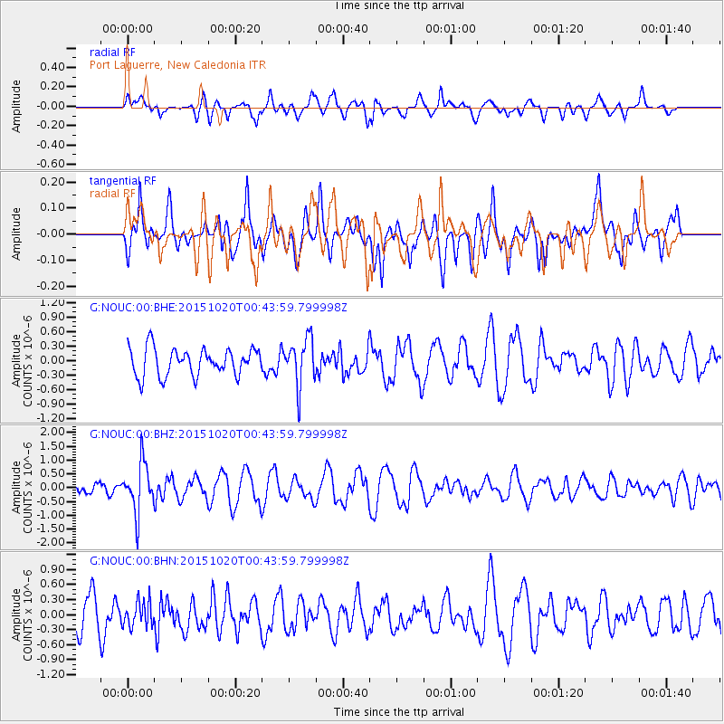
NOUC Port Laguerre, New Caledonia - Earthquake Result Viewer
*The percent match for this event was below the threshold and hence no stack was calculated.
| Earthquake location: |
South Of Mariana Islands |
| Earthquake latitude/longitude: |
12.8/143.9 |
| Earthquake time(UTC): |
2015/10/20 (293) 00:36:55 GMT |
| Earthquake Depth: |
93 km |
| Earthquake Magnitude: |
5.6 MB |
| Earthquake Catalog/Contributor: |
NEIC PDE/NEIC COMCAT |
|
| Network: |
G GEOSCOPE |
| Station: |
NOUC Port Laguerre, New Caledonia |
| Lat/Lon: |
22.10 S/166.30 E |
| Elevation: |
112 m |
|
| Distance: |
41.1 deg |
| Az: |
147.517 deg |
| Baz: |
325.612 deg |
| Ray Param: |
$rayparam |
*The percent match for this event was below the threshold and hence was not used in the summary stack. |
|
| Radial Match: |
69.40465 % |
| Radial Bump: |
400 |
| Transverse Match: |
65.99778 % |
| Transverse Bump: |
400 |
| SOD ConfigId: |
1259291 |
| Insert Time: |
2015-11-03 00:50:37.726 +0000 |
| GWidth: |
2.5 |
| Max Bumps: |
400 |
| Tol: |
0.001 |
|
Signal To Noise
| Channel | StoN | STA | LTA |
| G:NOUC:00:BHZ:20151020T00:43:59.799998Z | 2.9170866 | 9.015172E-7 | 3.090471E-7 |
| G:NOUC:00:BHN:20151020T00:43:59.799998Z | 0.79993117 | 2.5679543E-7 | 3.2102187E-7 |
| G:NOUC:00:BHE:20151020T00:43:59.799998Z | 1.7222165 | 4.8965666E-7 | 2.843177E-7 |
| Arrivals |
| Ps | |
| PpPs | |
| PsPs/PpSs | |


