You are here: Home > Network List > UU - University of Utah Regional Network Stations List
> Station CCUT Cedar City, UT, USA > Earthquake Result Viewer
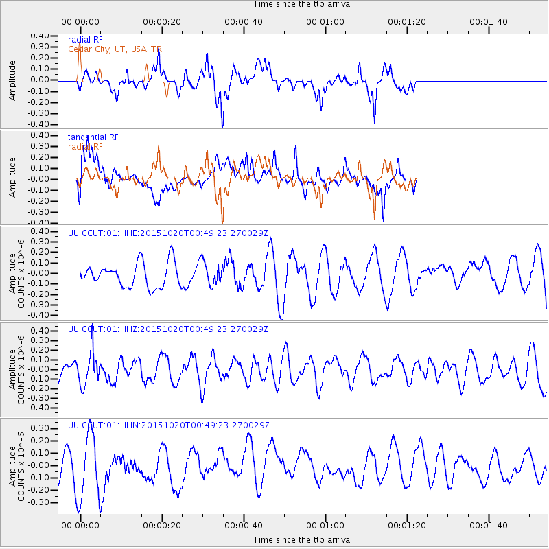
CCUT Cedar City, UT, USA - Earthquake Result Viewer
*The percent match for this event was below the threshold and hence no stack was calculated.
| Earthquake location: |
South Of Mariana Islands |
| Earthquake latitude/longitude: |
12.8/143.9 |
| Earthquake time(UTC): |
2015/10/20 (293) 00:36:55 GMT |
| Earthquake Depth: |
93 km |
| Earthquake Magnitude: |
5.6 MB |
| Earthquake Catalog/Contributor: |
NEIC PDE/NEIC COMCAT |
|
| Network: |
UU University of Utah Regional Network |
| Station: |
CCUT Cedar City, UT, USA |
| Lat/Lon: |
37.55 N/113.36 W |
| Elevation: |
2127 m |
|
| Distance: |
92.1 deg |
| Az: |
50.884 deg |
| Baz: |
287.803 deg |
| Ray Param: |
$rayparam |
*The percent match for this event was below the threshold and hence was not used in the summary stack. |
|
| Radial Match: |
61.9102 % |
| Radial Bump: |
400 |
| Transverse Match: |
57.517677 % |
| Transverse Bump: |
400 |
| SOD ConfigId: |
1259291 |
| Insert Time: |
2015-11-03 00:53:25.547 +0000 |
| GWidth: |
2.5 |
| Max Bumps: |
400 |
| Tol: |
0.001 |
|
Signal To Noise
| Channel | StoN | STA | LTA |
| UU:CCUT:01:HHZ:20151020T00:49:23.270029Z | 1.0493327 | 1.7425643E-7 | 1.6606404E-7 |
| UU:CCUT:01:HHN:20151020T00:49:23.270029Z | 2.1011434 | 2.7055364E-7 | 1.2876497E-7 |
| UU:CCUT:01:HHE:20151020T00:49:23.270029Z | 1.0079795 | 1.1339125E-7 | 1.1249361E-7 |
| Arrivals |
| Ps | |
| PpPs | |
| PsPs/PpSs | |


