You are here: Home > Network List > TA - USArray Transportable Network (new EarthScope stations) Stations List
> Station MDND Maddock, ND, USA > Earthquake Result Viewer
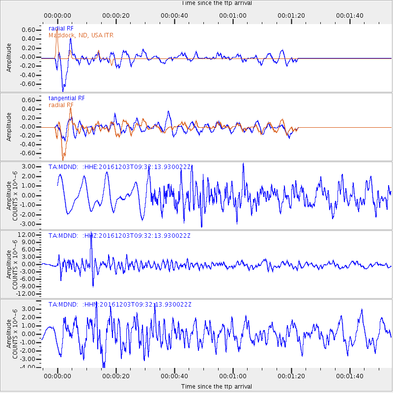
MDND Maddock, ND, USA - Earthquake Result Viewer
*The percent match for this event was below the threshold and hence no stack was calculated.
| Earthquake location: |
Near Islands, Aleutian Islands |
| Earthquake latitude/longitude: |
52.2/174.2 |
| Earthquake time(UTC): |
2016/12/03 (338) 09:23:34 GMT |
| Earthquake Depth: |
27 km |
| Earthquake Magnitude: |
6.0 mb |
| Earthquake Catalog/Contributor: |
NEIC PDE/us |
|
| Network: |
TA USArray Transportable Network (new EarthScope stations) |
| Station: |
MDND Maddock, ND, USA |
| Lat/Lon: |
47.85 N/99.60 W |
| Elevation: |
479 m |
|
| Distance: |
52.4 deg |
| Az: |
58.046 deg |
| Baz: |
309.238 deg |
| Ray Param: |
$rayparam |
*The percent match for this event was below the threshold and hence was not used in the summary stack. |
|
| Radial Match: |
66.82096 % |
| Radial Bump: |
383 |
| Transverse Match: |
70.11616 % |
| Transverse Bump: |
400 |
| SOD ConfigId: |
11737051 |
| Insert Time: |
2019-04-26 05:02:41.963 +0000 |
| GWidth: |
2.5 |
| Max Bumps: |
400 |
| Tol: |
0.001 |
|
Signal To Noise
| Channel | StoN | STA | LTA |
| TA:MDND: :HHZ:20161203T09:32:13.930022Z | 4.071303 | 1.9516215E-6 | 4.7936044E-7 |
| TA:MDND: :HHN:20161203T09:32:13.930022Z | 1.5539957 | 1.3575877E-6 | 8.73611E-7 |
| TA:MDND: :HHE:20161203T09:32:13.930022Z | 1.2020901 | 1.414692E-6 | 1.1768601E-6 |
| Arrivals |
| Ps | |
| PpPs | |
| PsPs/PpSs | |


